ملف:Map of Noordeinde Palace, the Palacegarden, Royal Archives and Royal Stables.svg

حجم معاينة PNG لذلك الملف ذي الامتداد SVG: 356 × 599 بكسل. البعد الآخر: 1٬217 × 2٬048 بكسل.
الملف الأصلي (ملف SVG، أبعاده 1٬405 × 2٬364 بكسل، حجم الملف: 3٫47 ميجابايت)
وصف قصير
| ⧼wm-license-information-description⧽ |
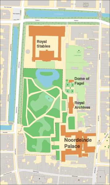
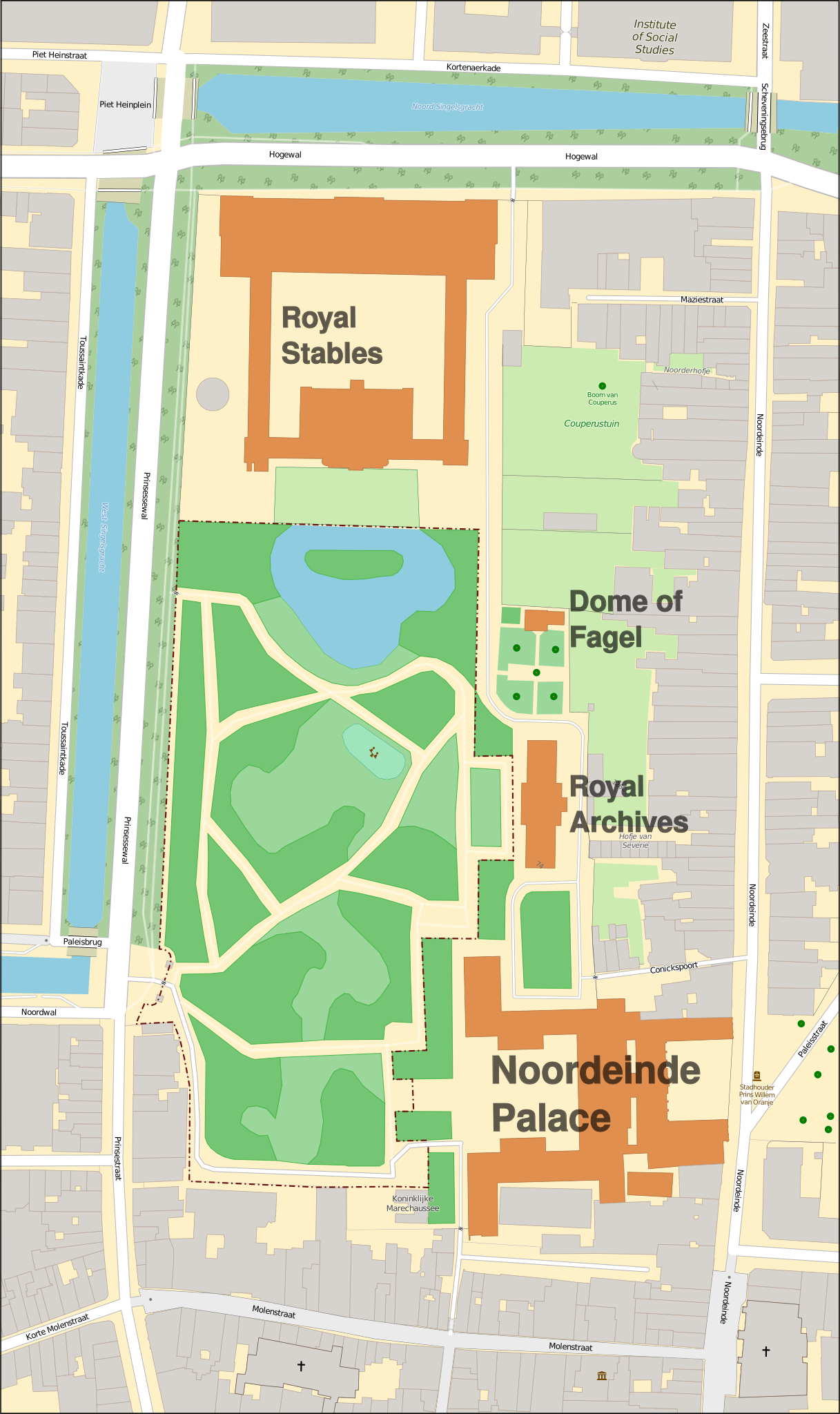
(Dutch) English: Map of the building complex of Noordeinde Palace in The Hague. With the adjecent palacegarden, the Royal Archives, Royal Stables and the garden dome of Fagel.
Deutsch: Karte des Palastkomplex des Noordeinde Palastes in Den Haag. Mit dem angrenzenden Palastgarten, dem Königlichen Archiv, dem Königlichen Stall und dem Gartenkuppel von Fagel.
Français : Le complexe du Palais Royale de Noordeinde à La Haye. Avec le palais adjacent, les Archives royales, les écuries royales et le dôme de jardin de Fagel.
|
| ⧼wm-license-information-date⧽ | 2017 |
| ⧼wm-license-information-source⧽ | ⧼Wm-license-own-work⧽ |
| ⧼wm-license-information-author⧽ | OSeveno |
ترخيص
تاريخ الملف
اضغط على زمن/تاريخ لرؤية الملف كما بدا في هذا الزمن.
| زمن/تاريخ | صورة مصغرة | الأبعاد | مستخدم | تعليق | |
|---|---|---|---|---|---|
| حالي | ★ مراجعة معتمدة 22:08، 8 أكتوبر 2023 | | 1٬405 × 2٬364 (3٫47 ميجابايت) | Pastakhov (نقاش | مساهمات) | Upload https://upload.wikimedia.org/wikipedia/commons/9/9c/Map_of_Noordeinde_Palace%2C_the_Palacegarden%2C_Royal_Archives_and_Royal_Stables.svg |
لا يمكنك استبدال هذا الملف.
وصلات
لا يوجد صفحات تصل لهذه الصورة.