ملف:Map of Iranian Azerbaijan 1945-46 insurgency by Robert Rossow.svg

حجم معاينة PNG لذلك الملف ذي الامتداد SVG: 800 × 536 بكسل. البعد الآخر: 2٬560 × 1٬714 بكسل.
الملف الأصلي (ملف SVG، أبعاده 1٬498 × 1٬003 بكسل، حجم الملف: 812 كيلوبايت)
وصف قصير
قالب:Igen
| ⧼wm-license-information-description⧽ |
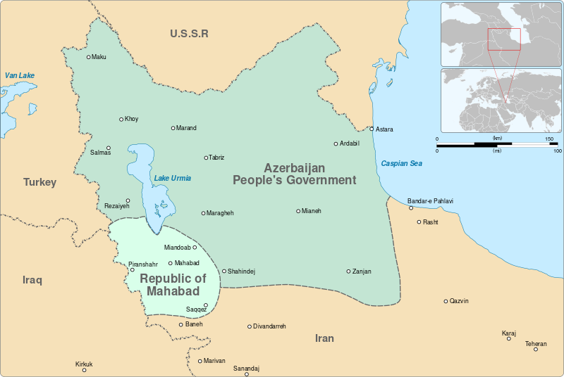
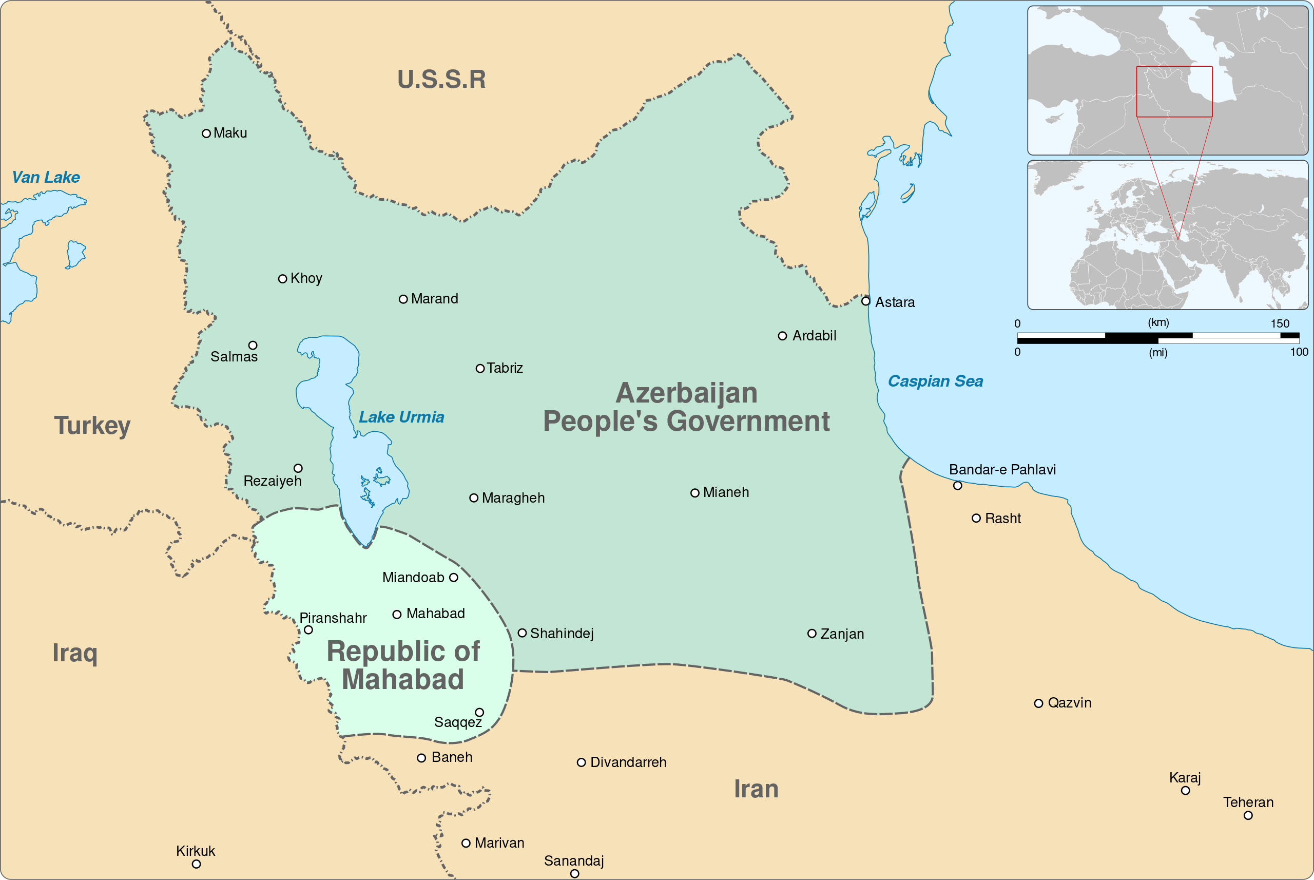
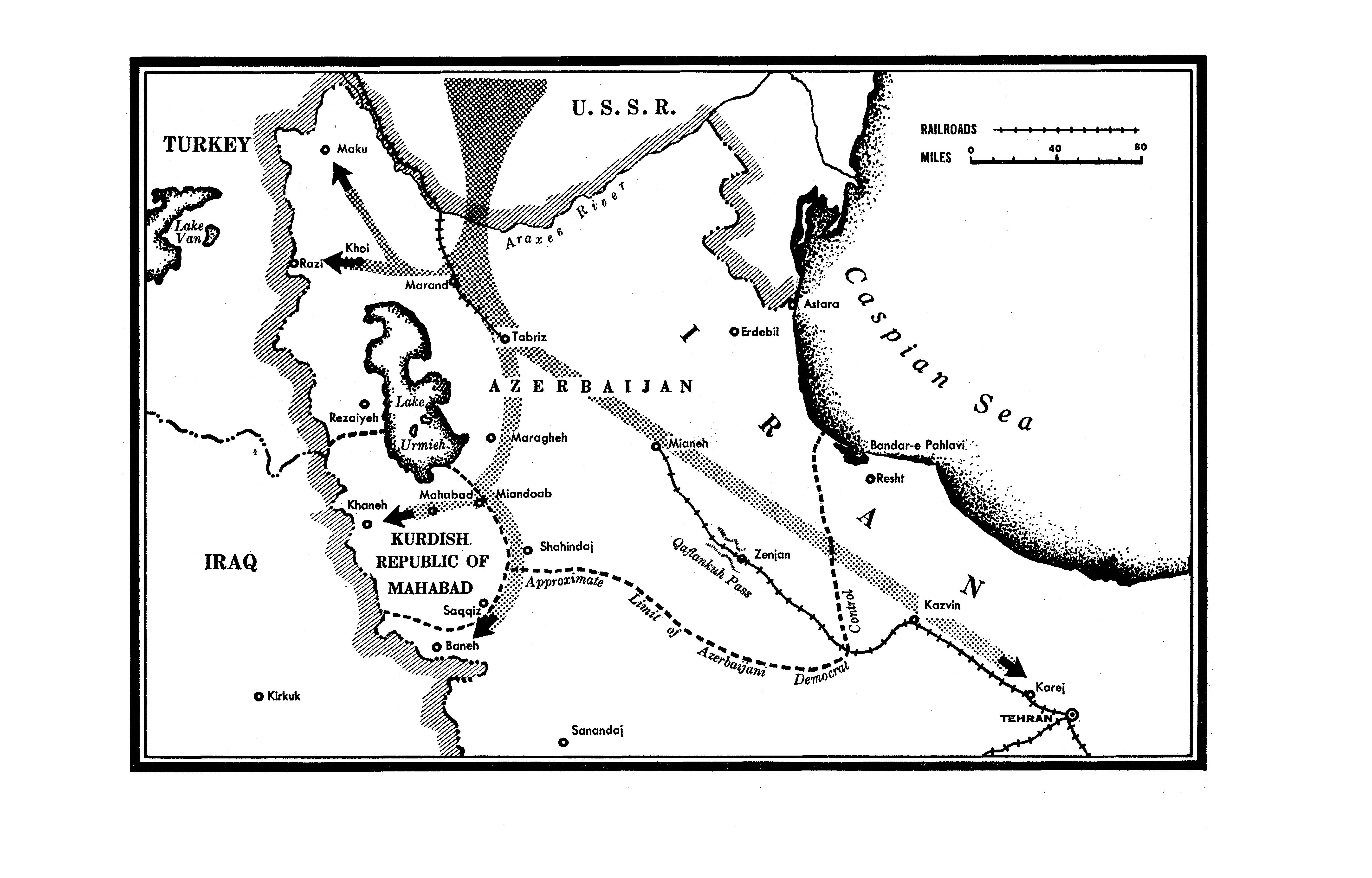
English: Map of Iranian Azerbaijan during 1945-1946, when it was occupied by the Red Army and the Soviet puppet states named Republic of Mahabad and People's Government of Azerbaijan. Boundaries are approximate and based on a work by Robert Rossow Jr., an American diplomat stationed in Tabriz.
قالب:Institution قالب:Institution قالب:Institution قالب:Institution |
||
| ⧼wm-license-information-date⧽ | 2023 | ||
| ⧼wm-license-information-source⧽ | قالب:Own based قالب:Own using OpenStreetMap |
||
| ⧼wm-license-information-author⧽ | Goran_tek-en | ||
| ⧼wm-license-information-permission⧽ (⧼wm-license-information-permission-reusing-text⧽) |
|
||
| ⧼wm-license-information-other-versions⧽ |
|

تاريخ الملف
اضغط على زمن/تاريخ لرؤية الملف كما بدا في هذا الزمن.
| زمن/تاريخ | صورة مصغرة | الأبعاد | مستخدم | تعليق | |
|---|---|---|---|---|---|
| حالي | ★ مراجعة معتمدة 02:08، 13 أكتوبر 2023 | | 1٬498 × 1٬003 (812 كيلوبايت) | Pastakhov (نقاش | مساهمات) | Upload https://upload.wikimedia.org/wikipedia/commons/8/86/Map_of_Iranian_Azerbaijan_1945-46_insurgency_by_Robert_Rossow.svg |
لا يمكنك استبدال هذا الملف.
وصلات
الصفحات التالية تحتوي على وصلة لهذه الصورة:
.svg)