ملف:Map of Hamilton County Ohio With Mariemont School District.PNG
لا توجد دقة أعلى متوفرة.
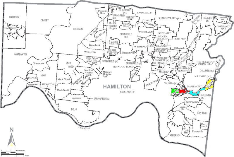
Map_of_Hamilton_County_Ohio_With_Mariemont_School_District.PNG (800 × 536 بكسل حجم الملف: 218 كيلوبايت، نوع MIME: image/png)
وصف قصير
| ⧼wm-license-information-description⧽ |
Map of Hamilton County, Ohio, United States showing Mariemont School District by Political Constituents |
| ⧼wm-license-information-date⧽ | 2008 |
| ⧼wm-license-information-source⧽ | taken from US Census website http://www2.census.gov/geo/maps/general_ref/cousub_outline/cen2k_pgsz/oh_cosub.pdf and modified by User:Ruhrfisch and User:Duke Ganote |
| ⧼wm-license-information-author⧽ | US Census, Ruhrfisch, Duke Ganote |
| ⧼wm-license-information-permission⧽ (⧼wm-license-information-permission-reusing-text⧽) |
US Census / US Government work is public domain, my modifications licensed under the GNU Free Documentation License |
| ⧼wm-license-information-other-versions⧽ |
Image:Map_of_Hamilton_County_Ohio_With_Anderson_Township.PNG |
ترخيص
تاريخ الملف
اضغط على زمن/تاريخ لرؤية الملف كما بدا في هذا الزمن.
| زمن/تاريخ | صورة مصغرة | الأبعاد | مستخدم | تعليق | |
|---|---|---|---|---|---|
| حالي | ★ مراجعة معتمدة 22:57، 6 نوفمبر 2023 | | 800 × 536 (218 كيلوبايت) | Pastakhov (نقاش | مساهمات) | Upload https://upload.wikimedia.org/wikipedia/commons/6/67/Map_of_Hamilton_County_Ohio_With_Mariemont_School_District.PNG |
لا يمكنك استبدال هذا الملف.
وصلات
لا يوجد صفحات تصل لهذه الصورة.