ملف:Map of Gauteng with Randfontein highlighted (2011).svg

حجم معاينة PNG لذلك الملف ذي الامتداد SVG: 595 × 600 بكسل. البعد الآخر: 2٬032 × 2٬048 بكسل.
الملف الأصلي (ملف SVG، أبعاده 754 × 760 بكسل، حجم الملف: 143 كيلوبايت)
وصف قصير
| ⧼wm-license-information-description⧽ |
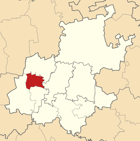
English: Map of municipal boundaries in Gauteng, as they will be after the municipal elections of 18 May 2011, with the Randfontein Local Municipality highlighted in red. Based on File:Map of Gauteng with municipalities blank (2011).svg.
|
| ⧼wm-license-information-date⧽ | 2011 |
| ⧼wm-license-information-source⧽ | ⧼Wm-license-own-work⧽ |
| ⧼wm-license-information-author⧽ | Htonl |
ترخيص
|

.svg&action=edit&redlink=1)
تاريخ الملف
اضغط على زمن/تاريخ لرؤية الملف كما بدا في هذا الزمن.
| زمن/تاريخ | صورة مصغرة | الأبعاد | مستخدم | تعليق | |
|---|---|---|---|---|---|
| حالي | ★ مراجعة معتمدة 22:44، 4 نوفمبر 2023 | | 754 × 760 (143 كيلوبايت) | Pastakhov (نقاش | مساهمات) | Upload https://upload.wikimedia.org/wikipedia/commons/3/36/Map_of_Gauteng_with_Randfontein_highlighted_%282011%29.svg |
لا يمكنك استبدال هذا الملف.
وصلات
لا يوجد صفحات تصل لهذه الصورة.
.svg&oldid=3375905)