ملف:Map of Chernigov Namestnichestvo 1796 (small atlas).jpg

حجم هذه المعاينة: 714 × 600 بكسل. البعدان الآخران: 2٬438 × 2٬048 بكسل | 2٬882 × 2٬421 بكسل.
الملف الأصلي (2٬882 × 2٬421 بكسل حجم الملف: 869 كيلوبايت، نوع MIME: image/jpeg)
وصف قصير
| ⧼wm-license-information-description⧽ |
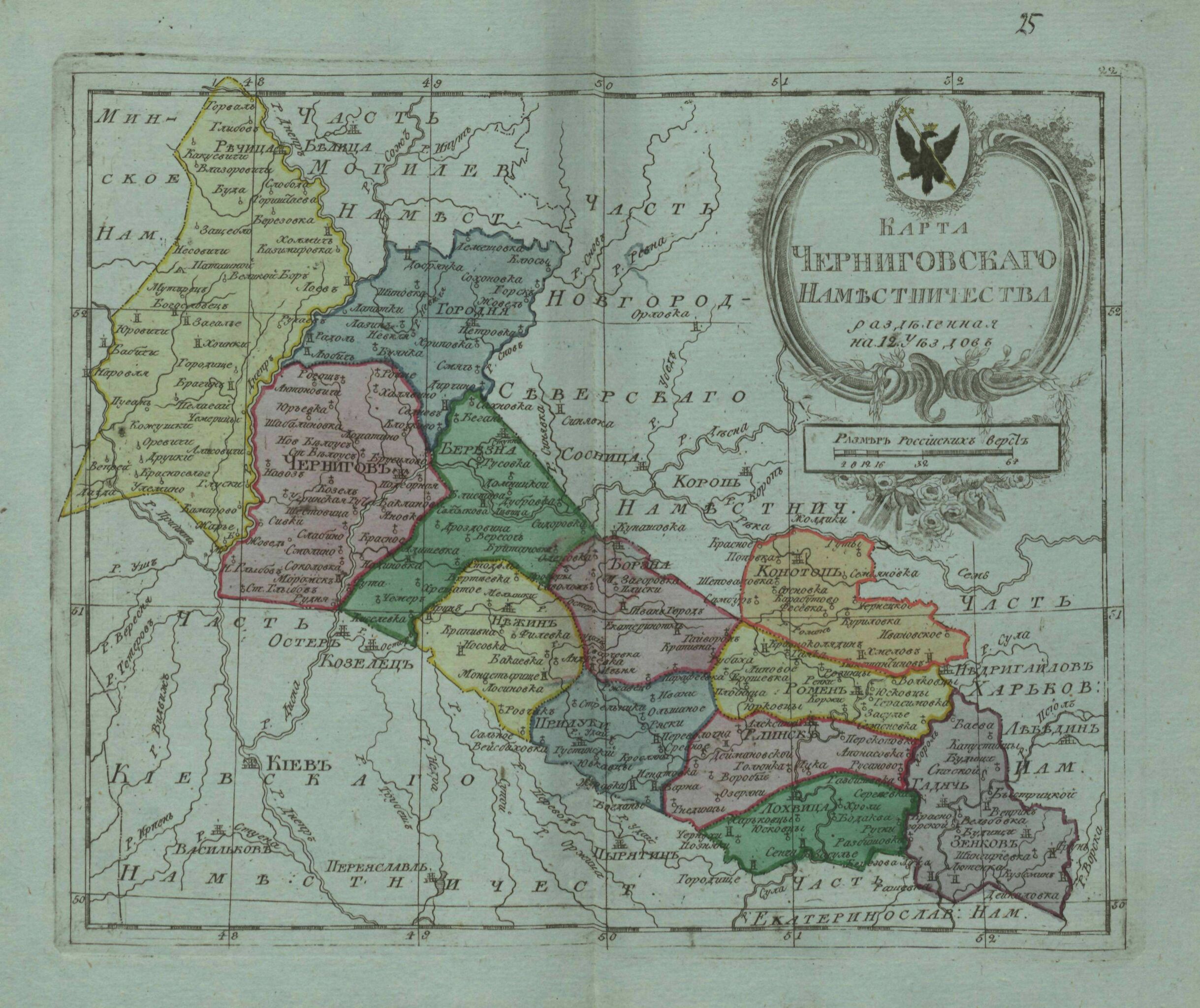
English: Small atlas of the Russian Empire (1796). Map of Сhernigov Namestnichestvo (map 25).
|
| ⧼wm-license-information-date⧽ | 1796 |
| ⧼wm-license-information-source⧽ | {{country data Атлас Российской империи, : Состоящий из 52 карт, : Изданный во граде св. Петра в лето 1796 е, а царствования Екатерины II XXXV е. Цифровая копия сделана Российской государственной библиотекой (http://www.rsl.ru)
| country flaglink | variant = | size = | name = | altlink = national rugby union team | altvar = rugby union }} English: Atlas of the Russian Empire, : Consist of 52 maps, : Published in St. Petersburg (1796). Digital copy made by Russian State Library (http://www.rsl.ru/en) |
| ⧼wm-license-information-author⧽ | قالب:Country data издатель: типография Сытина English: publisher:Sytin's print shop |
| ⧼wm-license-information-other-versions⧽ |
|
قالب:Works created more than 200 years ago
ترخيص
|
|
This file is in the ملكية عامة because its copyright has expired in the United States and those countries with a copyright term of no more than the life of the author plus 100 years.
|
تاريخ الملف
اضغط على زمن/تاريخ لرؤية الملف كما بدا في هذا الزمن.
| زمن/تاريخ | صورة مصغرة | الأبعاد | مستخدم | تعليق | |
|---|---|---|---|---|---|
| حالي | ★ مراجعة معتمدة 04:42، 27 يناير 2024 | | 2٬882 × 2٬421 (869 كيلوبايت) | Pastakhov (نقاش | مساهمات) | Upload https://upload.wikimedia.org/wikipedia/commons/3/36/Map_of_Chernigov_Namestnichestvo_1796_%28small_atlas%29.jpg |
لا يمكنك استبدال هذا الملف.
وصلات
لا يوجد صفحات تصل لهذه الصورة.
.jpg&oldid=3944589)