ملف:Map of Anhalt (1747-1793).svg

حجم معاينة PNG لذلك الملف ذي الامتداد SVG: 800 × 417 بكسل. البعد الآخر: 2٬560 × 1٬333 بكسل.
الملف الأصلي (ملف SVG، أبعاده 1٬544 × 804 بكسل، حجم الملف: 599 كيلوبايت)
وصف قصير
| ⧼wm-license-information-description⧽ |
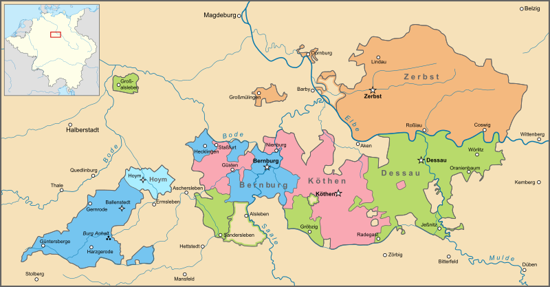
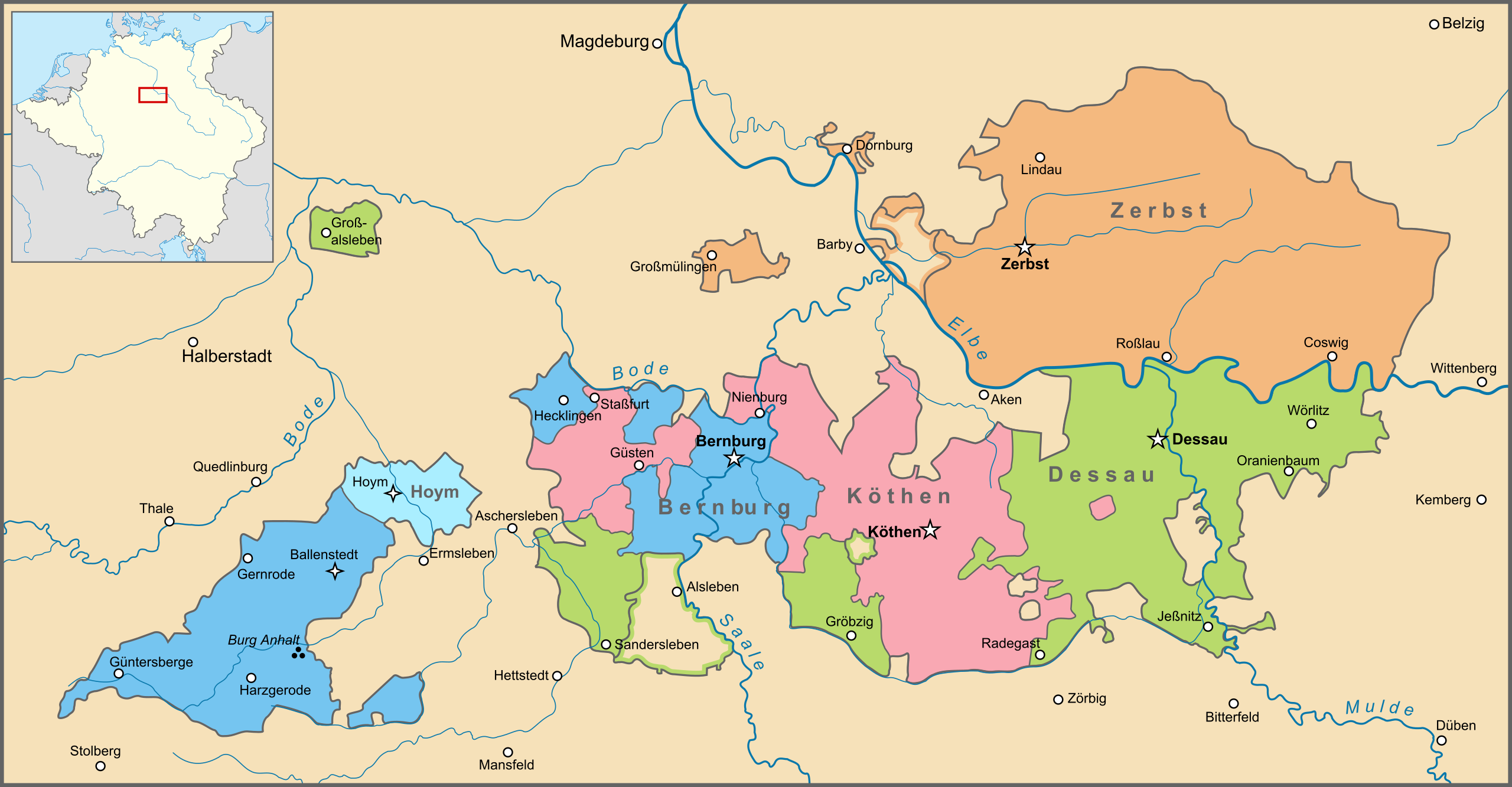
Deutsch: Karte von Anhalt zwischen 1747 und 1793, zwischen dem Kauf des Amtes Alsleben durch Anhalt-Dessau und dem Aussterben des Hauses Anhalt-Zerbst. English: Map of Anhalt between 1747 and 1793, between the purchase of the Amt Alsleben by Anhalt-Dessau and the extinction of the House of Anhalt-Zerbst. Nederlands: Kaart van Anhalt tussen 1747 en 1793, tussen de aankoop van het Amt Alsleben door Anhalt-Dessau en het uitsterven van het Huis Anhalt-Zerbst. |
| ⧼wm-license-information-date⧽ | 2013, {{time}} – invalid date format 55 (help) |
| ⧼wm-license-information-source⧽ | ⧼Wm-license-own-work⧽ |
| ⧼wm-license-information-author⧽ | Sir Iain |
ترخيص
|
تاريخ الملف
اضغط على زمن/تاريخ لرؤية الملف كما بدا في هذا الزمن.
| زمن/تاريخ | صورة مصغرة | الأبعاد | مستخدم | تعليق | |
|---|---|---|---|---|---|
| حالي | ★ مراجعة معتمدة 23:07، 3 نوفمبر 2023 | | 1٬544 × 804 (599 كيلوبايت) | Pastakhov (نقاش | مساهمات) | Upload https://upload.wikimedia.org/wikipedia/commons/c/c0/Map_of_Anhalt_%281747-1793%29.svg |
لا يمكنك استبدال هذا الملف.
وصلات
لا يوجد صفحات تصل لهذه الصورة.
.svg&oldid=3356524)