ملف:Map of Allegheny County Pennsylvania School Districts.png
حجم هذه المعاينة: 650 × 600 بكسل. البعد الآخر: 981 × 905 بكسل.
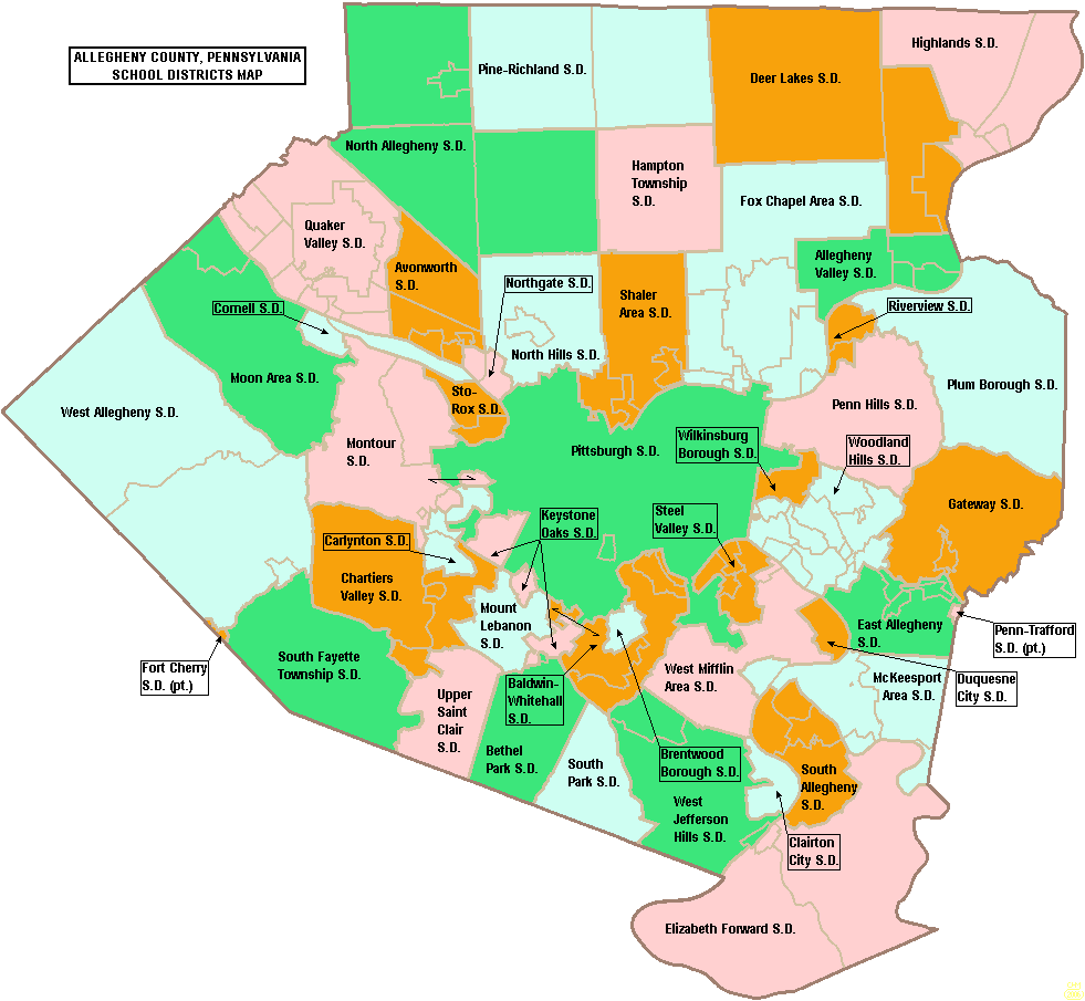
الملف الأصلي (981 × 905 بكسل حجم الملف: 70 كيلوبايت، نوع MIME: image/png)
وصف قصير
| ⧼wm-license-information-description⧽ |
Map of Allegheny County, Pennsylvania, United States Public School Districts |
| ⧼wm-license-information-date⧽ | 2006 |
| ⧼wm-license-information-source⧽ | taken from US Census website [1] and modified by User:Ruhrfisch |
| ⧼wm-license-information-author⧽ | US Census, Ruhrfisch |
| ⧼wm-license-information-permission⧽ (⧼wm-license-information-permission-reusing-text⧽) |
US Census / US Government work is public domain, my modifications licensed under the GNU Free Documentation License |
ترخيص
|

تاريخ الملف
اضغط على زمن/تاريخ لرؤية الملف كما بدا في هذا الزمن.
| زمن/تاريخ | صورة مصغرة | الأبعاد | مستخدم | تعليق | |
|---|---|---|---|---|---|
| حالي | ★ مراجعة معتمدة 12:40، 9 أكتوبر 2023 | | 981 × 905 (70 كيلوبايت) | Pastakhov (نقاش | مساهمات) | Upload https://upload.wikimedia.org/wikipedia/commons/8/83/Map_of_Allegheny_County_Pennsylvania_School_Districts.png |
لا يمكنك استبدال هذا الملف.
وصلات
لا يوجد صفحات تصل لهذه الصورة.