ملف:Map of Albert I Land north.jpg
حجم هذه المعاينة: 800 × 598 بكسل. البعد الآخر: 996 × 745 بكسل.
الملف الأصلي (996 × 745 بكسل حجم الملف: 163 كيلوبايت، نوع MIME: image/jpeg)
وصف قصير
| ⧼wm-license-information-description⧽ |
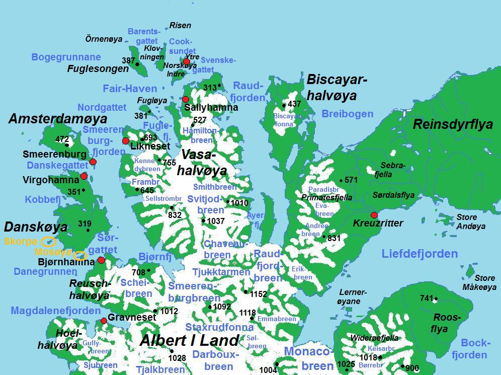
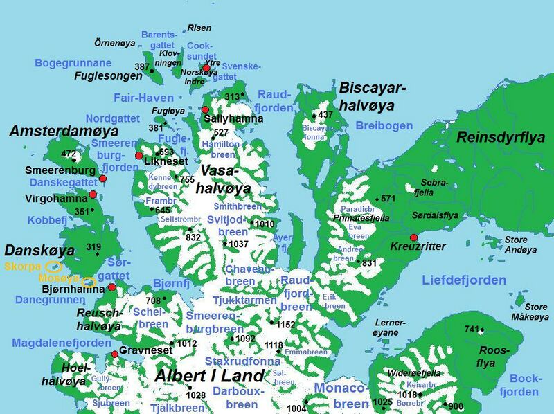
English: Map of the northern part of Albert I Land, northwestern Spitsbergen (Norway)
|
| ⧼wm-license-information-date⧽ | 2011 |
| ⧼wm-license-information-source⧽ | ⧼Wm-license-own-work⧽ |
| ⧼wm-license-information-author⧽ | Bjoertvedt |
ترخيص
|
تاريخ الملف
اضغط على زمن/تاريخ لرؤية الملف كما بدا في هذا الزمن.
| زمن/تاريخ | صورة مصغرة | الأبعاد | مستخدم | تعليق | |
|---|---|---|---|---|---|
| حالي | ★ مراجعة معتمدة 04:56، 2 نوفمبر 2023 | | 996 × 745 (163 كيلوبايت) | Pastakhov (نقاش | مساهمات) | Upload https://upload.wikimedia.org/wikipedia/commons/e/e4/Map_of_Albert_I_Land_north.jpg |
لا يمكنك استبدال هذا الملف.
وصلات
لا يوجد صفحات تصل لهذه الصورة.