ملف:Map from 1826 of proposed Chesapeake and Ohio Canal Route.jpg
حجم هذه المعاينة: 800 × 549 بكسل. البعد الآخر: 1٬000 × 686 بكسل.
الملف الأصلي (1٬000 × 686 بكسل حجم الملف: 672 كيلوبايت، نوع MIME: image/jpeg)
وصف قصير
| ⧼wm-license-information-description⧽ |
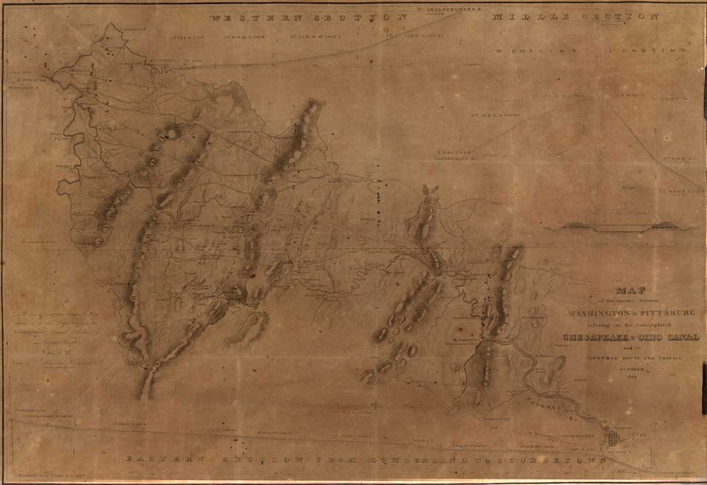
English: Scan of map (dated October 1826) of proposed route of Chesapeake and Ohio Canal, from Washington D.C. to Pittsburgh, PA, showing all three sections. Only the eastern portion was built up to Cumberland. Title says: MAP
of the country between WASHINGTON & PITTSBURG refering to the contemplated CHESAPEAKE & OHIO CANAL and its GENERAL ROUTE AND PROFILE OCTOBER 1826
|
| ⧼wm-license-information-date⧽ | 1826 |
| ⧼wm-license-information-source⧽ | Western Maryland Historical Library http://www.whilbr.org/itemdetail.aspx?idEntry=5920&dtPointer=0 |
| ⧼wm-license-information-author⧽ | Lieut. Farley, Wm. Harrison, D. R. Harrison |
ترخيص
تاريخ الملف
اضغط على زمن/تاريخ لرؤية الملف كما بدا في هذا الزمن.
| زمن/تاريخ | صورة مصغرة | الأبعاد | مستخدم | تعليق | |
|---|---|---|---|---|---|
| حالي | ★ مراجعة معتمدة 04:29، 2 نوفمبر 2023 | | 1٬000 × 686 (672 كيلوبايت) | Pastakhov (نقاش | مساهمات) | Upload https://upload.wikimedia.org/wikipedia/commons/7/7c/Map_from_1826_of_proposed_Chesapeake_and_Ohio_Canal_Route.jpg |
لا يمكنك استبدال هذا الملف.
وصلات
لا يوجد صفحات تصل لهذه الصورة.