ملف:Map Thirty Years War-fr.svg

حجم معاينة PNG لذلك الملف ذي الامتداد SVG: 462 × 599 بكسل. البعد الآخر: 1٬580 × 2٬048 بكسل.
الملف الأصلي (ملف SVG، أبعاده 715 × 927 بكسل، حجم الملف: 92 كيلوبايت)
| ⧼wm-license-information-description⧽ |
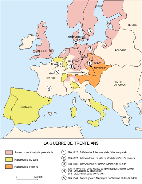
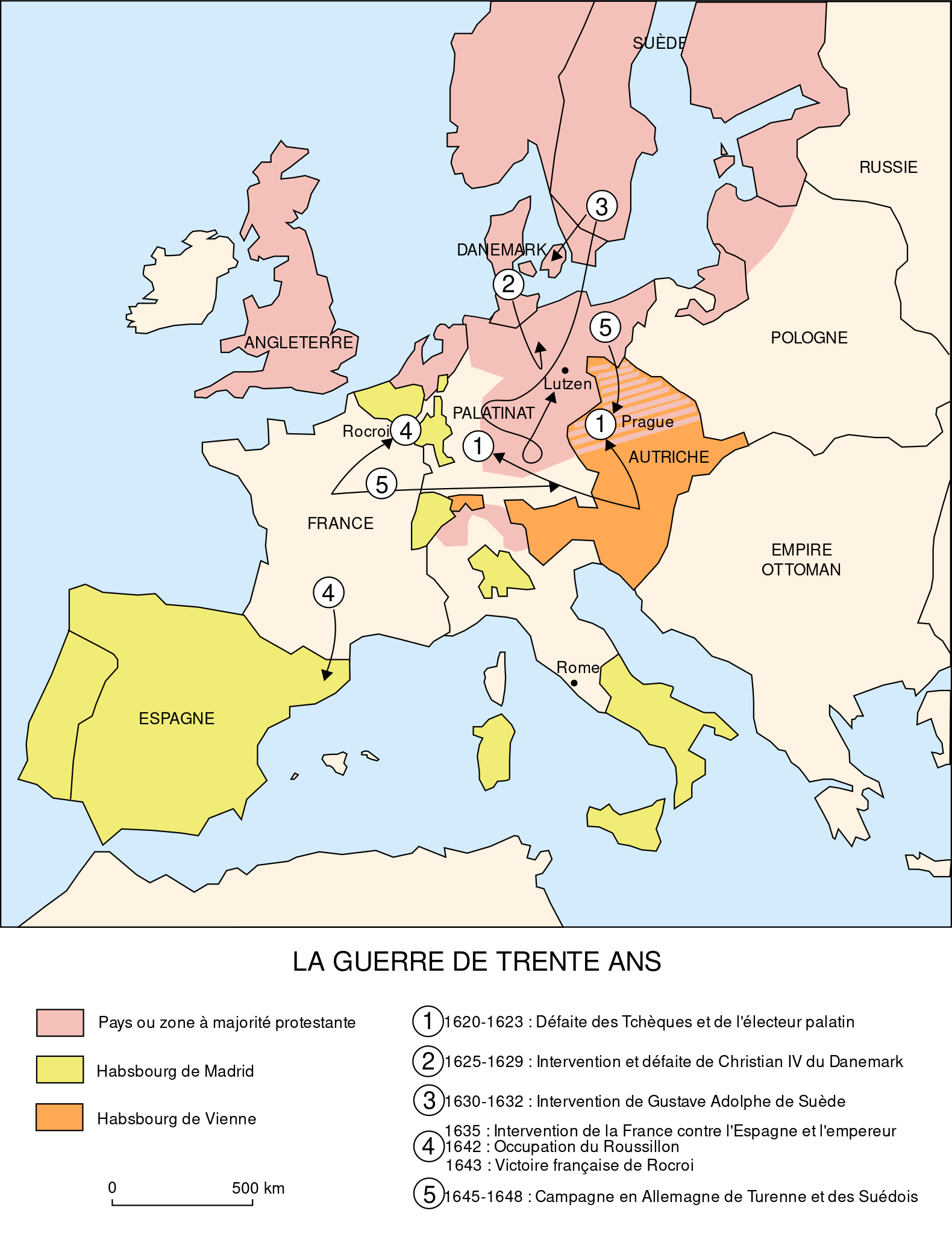
Français : Carte de la Guerre de Trente Ans, sans les principautés chrétiennes tributaires de l'Empire Ottoman, mais non turques, dont la Transylvanie de Gábor Bethlen qui, en 1619, s’engage dans la guerre de Trente Ans aux côtés de la Bohême, contre les Habsbourg. English: Map of the Thirty Years' War, without the christian principalities, tributary of the Ottoman Empire, but not turkish, as Gábor Bethlen's Transylvania, which join the war against the Habsburgs in 1619.
|
|||
| ⧼wm-license-information-date⧽ | 2006 | |||
| ⧼wm-license-information-source⧽ | Création personnelle. Image renommée depuis Image:La guerre de Trente Ans.svg | |||
| ⧼wm-license-information-author⧽ | historicair | |||
| ⧼wm-license-information-permission⧽ (⧼wm-license-information-permission-reusing-text⧽) |
|
|||
| ⧼wm-license-information-other-versions⧽ |

تاريخ الملف
اضغط على زمن/تاريخ لرؤية الملف كما بدا في هذا الزمن.
| زمن/تاريخ | صورة مصغرة | الأبعاد | مستخدم | تعليق | |
|---|---|---|---|---|---|
| حالي | ★ مراجعة معتمدة 22:46، 15 أكتوبر 2023 | | 715 × 927 (92 كيلوبايت) | Pastakhov (نقاش | مساهمات) | Upload https://upload.wikimedia.org/wikipedia/commons/7/74/Map_Thirty_Years_War-fr.svg |
لا يمكنك استبدال هذا الملف.
وصلات
لا يوجد صفحات تصل لهذه الصورة.