ملف:Map Bous-Waldbredimus.png

حجم هذه المعاينة: 433 × 599 بكسل. البعد الآخر: 747 × 1٬033 بكسل.
الملف الأصلي (747 × 1٬033 بكسل حجم الملف: 115 كيلوبايت، نوع MIME: image/png)
وصف قصير
| ⧼wm-license-information-description⧽ |
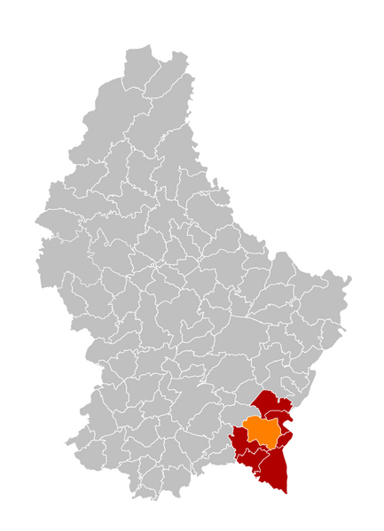
English: Location of the municipality of Bous-Waldbredimus (orange), canton of Remich (red), Luxembourg; result of the merger of the municipalities of Bous and Waldbredimus, per 01-09-2023.
|
| ⧼wm-license-information-date⧽ | 2023 |
| ⧼wm-license-information-source⧽ | based on قالب:F by v under licence ArtLibre or CC-BY-SA 4.0 |
| ⧼wm-license-information-author⧽ | User:GilPe |
ترخيص
|
|
هذا العمل مرخّص تحت رخصة المشاع الإبداعي الملزمة بنسبة العمل لمؤلفه وبترخيص الأعمال المشتقة بالمثل 4.0. |
تاريخ الملف
اضغط على زمن/تاريخ لرؤية الملف كما بدا في هذا الزمن.
| زمن/تاريخ | صورة مصغرة | الأبعاد | مستخدم | تعليق | |
|---|---|---|---|---|---|
| حالي | ★ مراجعة معتمدة 17:08، 13 أكتوبر 2023 | | 747 × 1٬033 (115 كيلوبايت) | Pastakhov (نقاش | مساهمات) | Upload https://upload.wikimedia.org/wikipedia/commons/8/86/Map_Bous-Waldbredimus.png |
لا يمكنك استبدال هذا الملف.
وصلات
لا يوجد صفحات تصل لهذه الصورة.