ملف:Map-shikotsu.png
لا توجد دقة أعلى متوفرة.
Map-shikotsu.png (600 × 500 بكسل حجم الملف: 176 كيلوبايت، نوع MIME: image/png)
وصف قصير
| ⧼wm-license-information-description⧽ |
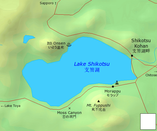
English: Locator map of Lake Shikotsu — a caldera lake in Chitose, Hokkaido, northern Japan.
|
| ⧼wm-license-information-date⧽ | قالب:Original upload date |
| ⧼wm-license-information-source⧽ | ⧼Wm-license-own-work⧽ |
| ⧼wm-license-information-author⧽ | قالب:User at project |
ترخيص
|
قالب:Original upload log
Wikivoyage has a travel guide for en.
قالب:Original description page
- 2005-05-01 08:27 (WT-en) Jpatokal 702×501 (85575 bytes) Map of Lake Shikotsu, Japan -- by jpatokal based on PD rendering by demis.nl (Import from wikitravel.org/en)
- 2005-05-01 08:34 (WT-en) Jpatokal 600×500 (70367 bytes) Smaller version (less wasted space) (Import from wikitravel.org/en)
- 2012-09-14 21:40 (WT-en) Jpatokal 600×500 (180588 bytes) cleanup
تاريخ الملف
اضغط على زمن/تاريخ لرؤية الملف كما بدا في هذا الزمن.
| زمن/تاريخ | صورة مصغرة | الأبعاد | مستخدم | تعليق | |
|---|---|---|---|---|---|
| حالي | ★ مراجعة معتمدة 01:06، 11 أكتوبر 2023 | | 600 × 500 (176 كيلوبايت) | Pastakhov (نقاش | مساهمات) | Upload https://upload.wikimedia.org/wikipedia/commons/a/a7/Map-shikotsu.png |
لا يمكنك استبدال هذا الملف.
وصلات
لا يوجد صفحات تصل لهذه الصورة.