ملف:Map-Prussia-LowerRhine.svg

حجم معاينة PNG لذلك الملف ذي الامتداد SVG: 684 × 600 بكسل. البعد الآخر: 2٬337 × 2٬048 بكسل.
الملف الأصلي (ملف SVG، أبعاده 1٬798 × 1٬576 بكسل، حجم الملف: 1٫27 ميجابايت)
| ⧼wm-license-information-description⧽ |
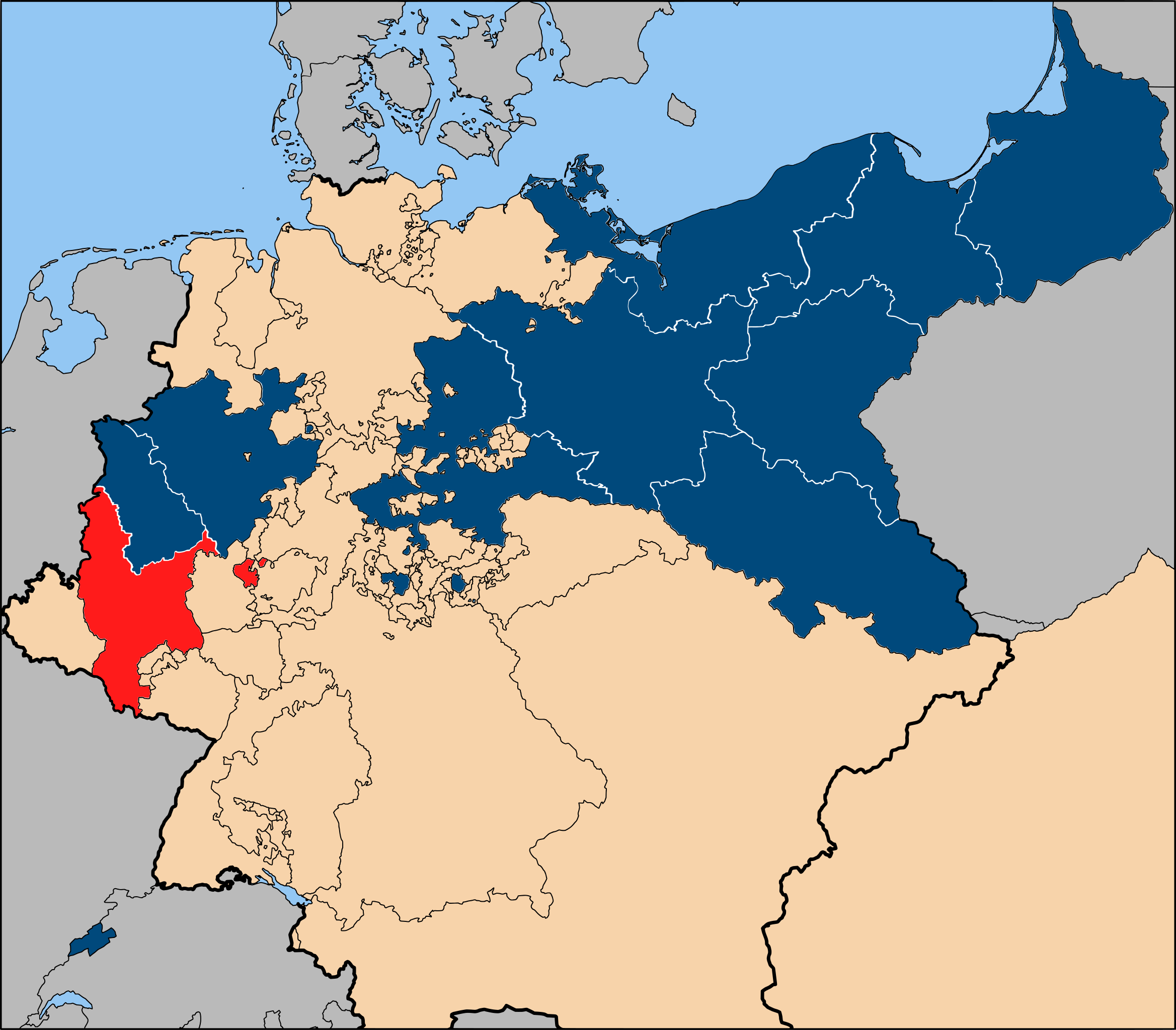
The Prussian province of the [Grand Duchy of the Lower Rhine ], within the [Kingdom of Prussia ] (blue). |
| ⧼wm-license-information-date⧽ | 2006 |
| ⧼wm-license-information-source⧽ | Based on map data of the IEG-Maps project (Andreas Kunz, B. Johnen and Joachim Robert Moeschl: University of Mainz) - http://www.ieg-maps.uni-mainz.de |
| ⧼wm-license-information-author⧽ | User:52 Pickup |
| ⧼wm-license-information-permission⧽ (⧼wm-license-information-permission-reusing-text⧽) |
تاريخ الملف
اضغط على زمن/تاريخ لرؤية الملف كما بدا في هذا الزمن.
| زمن/تاريخ | صورة مصغرة | الأبعاد | مستخدم | تعليق | |
|---|---|---|---|---|---|
| حالي | ★ مراجعة معتمدة 17:32، 12 يناير 2024 | | 1٬798 × 1٬576 (1٫27 ميجابايت) | Pastakhov (نقاش | مساهمات) | Upload https://upload.wikimedia.org/wikipedia/commons/1/17/Map-Prussia-LowerRhine.svg |
لا يمكنك استبدال هذا الملف.
وصلات
لا يوجد صفحات تصل لهذه الصورة.