ملف:Manistique Michigan aerial view.jpg

حجم هذه المعاينة: 800 × 562 بكسل. البعد الآخر: 1٬500 × 1٬053 بكسل.
الملف الأصلي (1٬500 × 1٬053 بكسل حجم الملف: 601 كيلوبايت، نوع MIME: image/jpeg)
| ⧼wm-license-information-description⧽ |
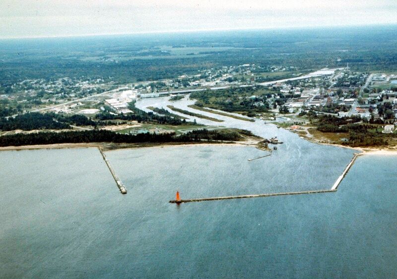
English: Aerial view of Manistique, Michigan, USA. The city lies on the northern shore of Lake Michigan in the Upper Peninsula of Michigan. The Manistique River flows through the town and into Lake Michigan through the harbor.
|
| ⧼wm-license-information-date⧽ | not specified or unknown |
| ⧼wm-license-information-source⧽ | U.S. Army Corps of Engineers Digital Visual Library Image page Image description page Digital Visual Library home page |
| ⧼wm-license-information-author⧽ | U.S. Army Corps of Engineers, photographer not specified or unknown |
| ⧼wm-license-information-permission⧽ (⧼wm-license-information-permission-reusing-text⧽) |
|
| قالب:Location/i18n | Manistique, Schoolcraft County, Michigan, USA |
تاريخ الملف
اضغط على زمن/تاريخ لرؤية الملف كما بدا في هذا الزمن.
| زمن/تاريخ | صورة مصغرة | الأبعاد | مستخدم | تعليق | |
|---|---|---|---|---|---|
| حالي | ★ مراجعة معتمدة 03:17، 28 نوفمبر 2023 | | 1٬500 × 1٬053 (601 كيلوبايت) | Pastakhov (نقاش | مساهمات) | Upload https://upload.wikimedia.org/wikipedia/commons/1/1b/Manistique_Michigan_aerial_view.jpg |
لا يمكنك استبدال هذا الملف.
وصلات
لا يوجد صفحات تصل لهذه الصورة.