ملف:Manhay Luxembourg Belgium Map.svg

حجم معاينة PNG لذلك الملف ذي الامتداد SVG: 437 × 599 بكسل. البعد الآخر: 1٬494 × 2٬048 بكسل.
الملف الأصلي (ملف SVG، أبعاده 537 × 736 بكسل، حجم الملف: 3٫25 ميجابايت)
وصف قصير
| ⧼wm-license-information-description⧽ |
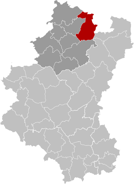
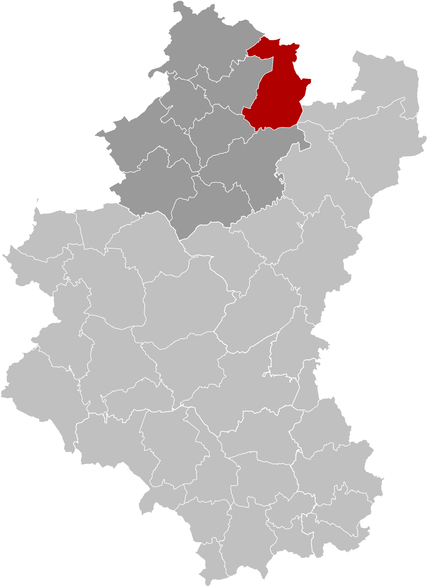
Français : Carte indiquant la localisation de la commune de Manhay en rouge dans son arrondissement et la province du Luxembourg.
English: Map of Manhay in province of Luxembourg, Belgium.
|
| ⧼wm-license-information-date⧽ | 2019 |
| ⧼wm-license-information-source⧽ | ⧼Wm-license-own-work⧽ |
| ⧼wm-license-information-author⧽ | OD02fr |
ترخيص
|
تاريخ الملف
اضغط على زمن/تاريخ لرؤية الملف كما بدا في هذا الزمن.
| زمن/تاريخ | صورة مصغرة | الأبعاد | مستخدم | تعليق | |
|---|---|---|---|---|---|
| حالي | ★ مراجعة معتمدة 18:31، 29 أكتوبر 2023 | | 537 × 736 (3٫25 ميجابايت) | Pastakhov (نقاش | مساهمات) | Upload https://upload.wikimedia.org/wikipedia/commons/1/1e/Manhay_Luxembourg_Belgium_Map.svg |
لا يمكنك استبدال هذا الملف.
وصلات
لا يوجد صفحات تصل لهذه الصورة.