ملف:Manchester from the air (geograph 6532147).jpg

حجم هذه المعاينة: 800 × 600 بكسل. البعد الآخر: 1٬024 × 768 بكسل.
الملف الأصلي (1٬024 × 768 بكسل حجم الملف: 540 كيلوبايت، نوع MIME: image/jpeg)
وصف قصير
| Description |
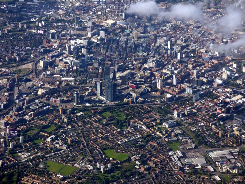
English: Manchester from the air. Looking over Hulme towards the city centre from above Northenden (4 miles south) from a Prague bound flight from Manchester. The A57(M) road marks the clear boundary between city and suburb. |
| Date | 2020-07-06 |
| Source | From geograph.org.uk |
| Author | Thomas Nugent |
| ⧼wm-license-information-permission⧽ (⧼wm-license-information-permission-reusing-text⧽) |
Creative Commons Attribution Share-alike license 2.0 |
| ⧼wm-license-cc-attribution⧽ (قالب:I18n/Credit line) |
Thomas Nugent / Manchester from the air / |
| Object location | Heading=0° | View all coordinates using: OpenStreetMap |
|---|
.jpg¶ms=053.464980_N_-002.250000_E_globe:Earth_class:object_type:object_source:geograph-osgb36(SJ8396)_heading:0.00&language=⧼lang⧽)
ترخيص
|
|
This image was taken from the Geograph project collection. See this photograph's page on the Geograph website for the photographer's contact details. The copyright on this image is owned by Thomas Nugent and is licensed for reuse under the Creative Commons Attribution-ShareAlike 2.0 license. |
|
|
This work is licensed under the Creative Commons Attribution-ShareAlike 2.0 License. Attribution: Thomas Nugent |
تاريخ الملف
اضغط على زمن/تاريخ لرؤية الملف كما بدا في هذا الزمن.
| زمن/تاريخ | صورة مصغرة | الأبعاد | مستخدم | تعليق | |
|---|---|---|---|---|---|
| حالي | ★ مراجعة معتمدة 09:04، 23 نوفمبر 2023 | | 1٬024 × 768 (540 كيلوبايت) | Pastakhov (نقاش | مساهمات) | Upload https://upload.wikimedia.org/wikipedia/commons/5/5c/Manchester_from_the_air_%28geograph_6532147%29.jpg |
لا يمكنك استبدال هذا الملف.
وصلات
لا يوجد صفحات تصل لهذه الصورة.
.jpg&oldid=3574858)