ملف:ME-FRGR1903-Loire.png
حجم هذه المعاينة: 800 × 566 بكسل. البعدان الآخران: 2٬560 × 1٬810 بكسل | 3٬507 × 2٬480 بكسل.
الملف الأصلي (3٬507 × 2٬480 بكسل حجم الملف: 1٫22 ميجابايت، نوع MIME: image/png)
وصف قصير
| ⧼wm-license-information-description⧽ |
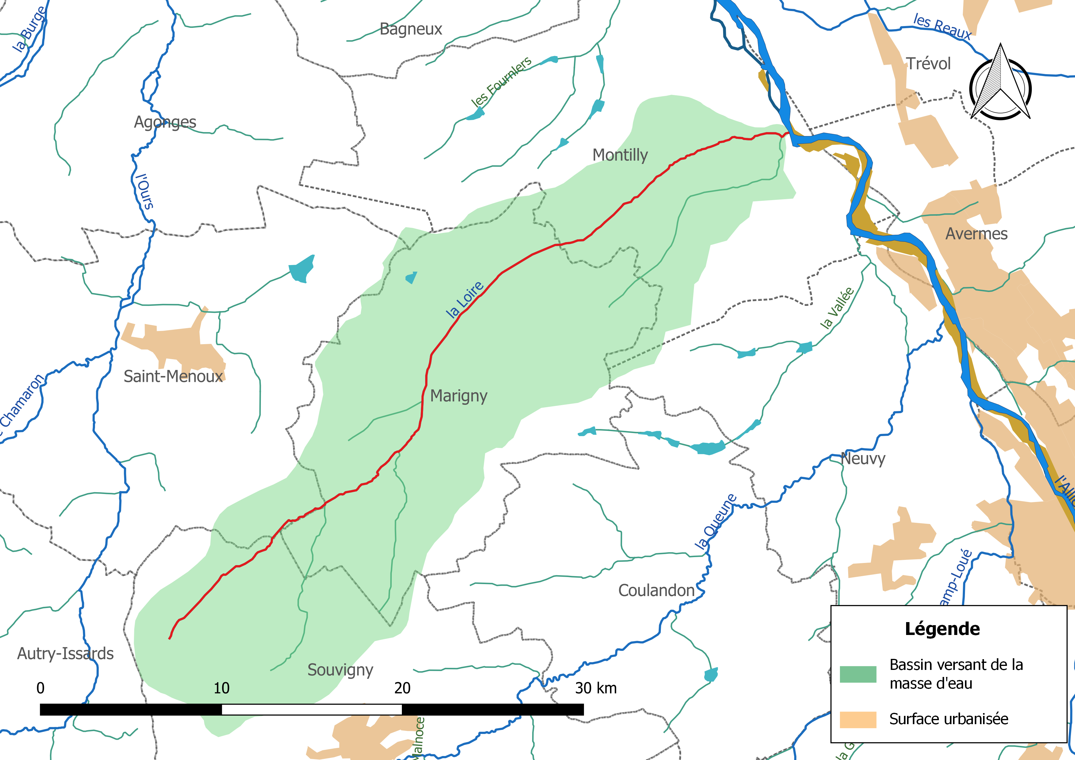
Français : Carte de la masse d'eau « FRGR1903 », avec mise en exergue du cours d'eau « la Loire », affluent de l'Allier (en rouge).
|
| ⧼wm-license-information-date⧽ | 2019 |
| ⧼wm-license-information-source⧽ | ⧼Wm-license-own-work⧽ |
| ⧼wm-license-information-author⧽ | Roland45 |
Sources :
- Limites communales : Découpage administratif communal français issu d'OpenStreetMap - version au 1er janvier 2019
- Cours d'eau : Cours d'eau - Métropole 2014 - BD Carthage
- Masses d'eau : https://www.data.gouv.fr/fr/datasets/bassins-versants-des-masses-deau-loire-bretagne/ Masses d'eau du bassin Loire-Bretagne] - Données 2015 actualisées février 2019
Assemblé et enrichi dans QGis.
ترخيص
|
تاريخ الملف
اضغط على زمن/تاريخ لرؤية الملف كما بدا في هذا الزمن.
| زمن/تاريخ | صورة مصغرة | الأبعاد | مستخدم | تعليق | |
|---|---|---|---|---|---|
| حالي | ★ مراجعة معتمدة 08:23، 9 ديسمبر 2023 | | 3٬507 × 2٬480 (1٫22 ميجابايت) | Pastakhov (نقاش | مساهمات) | Upload https://upload.wikimedia.org/wikipedia/commons/4/4e/ME-FRGR1903-Loire.png |
لا يمكنك استبدال هذا الملف.
وصلات
لا يوجد صفحات تصل لهذه الصورة.