ملف:Lower Mainland of British Columbia, 2012.jpg
حجم هذه المعاينة: 800 × 419 بكسل. البعدان الآخران: 2٬560 × 1٬341 بكسل | 4٬200 × 2٬200 بكسل.
الملف الأصلي (4٬200 × 2٬200 بكسل حجم الملف: 3٫01 ميجابايت، نوع MIME: image/jpeg)
وصف قصير
| ⧼wm-license-information-description⧽ |
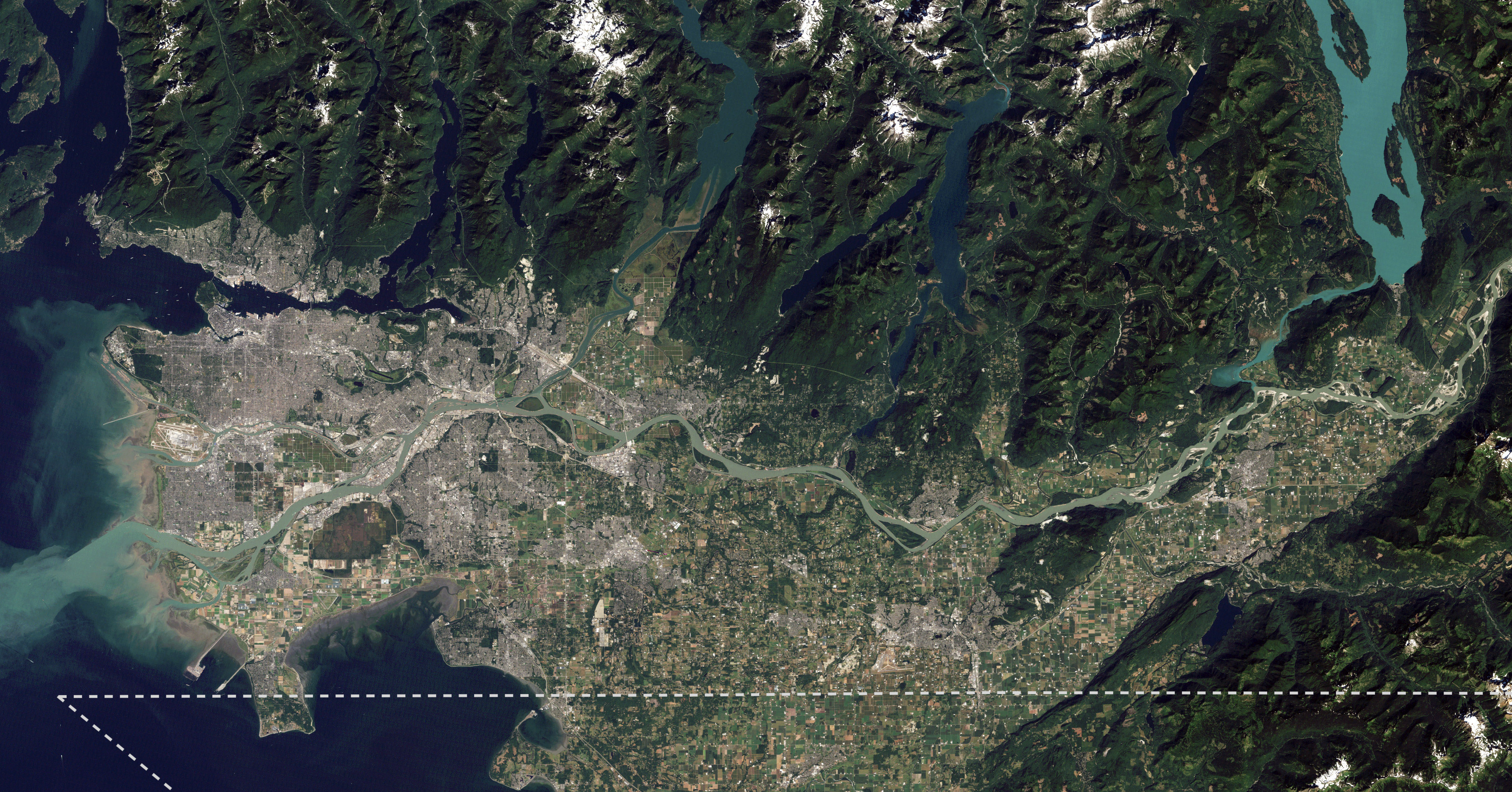
English: I took NASA's beautiful satellite image of the Fraser Lowland from 2012 and cropped into the core area of the Lower Mainland. I also added an approximate Canada-US border line meant for visual reference. This image is meant to replace an older satellite image that outlining the Lower Mainland in red.
|
| ⧼wm-license-information-date⧽ | 2012, {{time}} – invalid date format 01 (help) |
| ⧼wm-license-information-source⧽ | The Big Muddy, Western Edition |
| ⧼wm-license-information-author⧽ | NASA Goddard Space Flight Center from Greenbelt, MD, USA |
| ⧼wm-license-information-other-versions⧽ |
.jpg)
ترخيص
تاريخ الملف
اضغط على زمن/تاريخ لرؤية الملف كما بدا في هذا الزمن.
| زمن/تاريخ | صورة مصغرة | الأبعاد | مستخدم | تعليق | |
|---|---|---|---|---|---|
| حالي | ★ مراجعة معتمدة 13:19، 27 أكتوبر 2023 | | 4٬200 × 2٬200 (3٫01 ميجابايت) | Pastakhov (نقاش | مساهمات) | Upload https://upload.wikimedia.org/wikipedia/commons/e/e6/Lower_Mainland_of_British_Columbia%2C_2012.jpg |
لا يمكنك استبدال هذا الملف.
وصلات
لا يوجد صفحات تصل لهذه الصورة.