ملف:Low Newton-by-the-Sea - geograph.org.uk - 427349.jpg
لا توجد دقة أعلى متوفرة.
Low_Newton-by-the-Sea_-_geograph.org.uk_-_427349.jpg (640 × 427 بكسل حجم الملف: 61 كيلوبايت، نوع MIME: image/jpeg)
وصف قصير
| ⧼wm-license-information-description⧽ |
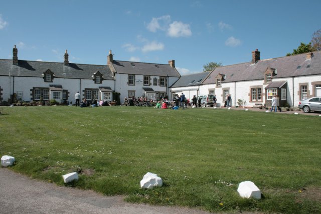
English: Low Newton-by-the-Sea Sometimes referred to by the names of the bay, St Mary's or Newton Haven, this pretty little village is almost entirely owned by the National Trust. At the far end of the green is the Ship Inn.
|
| ⧼wm-license-information-date⧽ | 2007 |
| ⧼wm-license-information-source⧽ | From geograph.org.uk |
| ⧼wm-license-information-author⧽ | Mick Garratt |
| ⧼wm-license-cc-attribution⧽ (قالب:I18n/Credit line) |
Mick Garratt / Low Newton-by-the-Sea / |
55°30′49″N 1°37′09″W / 55.51353°N 1.6192°W قالب:Object location
_heading:270)
ترخيص
تاريخ الملف
اضغط على زمن/تاريخ لرؤية الملف كما بدا في هذا الزمن.
| زمن/تاريخ | صورة مصغرة | الأبعاد | مستخدم | تعليق | |
|---|---|---|---|---|---|
| حالي | ★ مراجعة معتمدة 01:16، 16 يناير 2024 | | 640 × 427 (61 كيلوبايت) | Pastakhov (نقاش | مساهمات) | Upload https://upload.wikimedia.org/wikipedia/commons/a/a8/Low_Newton-by-the-Sea_-_geograph.org.uk_-_427349.jpg |
لا يمكنك استبدال هذا الملف.
وصلات
لا يوجد صفحات تصل لهذه الصورة.