ملف:London Overground map sb.svg

حجم معاينة PNG لذلك الملف ذي الامتداد SVG: 710 × 599 بكسل. البعد الآخر: 2٬426 × 2٬048 بكسل.
الملف الأصلي (ملف SVG متحرك، بمقاسات 1٬220 × 1٬030 بكسل، حجم الملف: 52 كيلوبايت)
ملاحظة: نظراً للقيود التقنية، فإن الصورة المصغرة لهذا الملف ستكون غير متحركة.
وصف قصير
| ⧼wm-license-information-description⧽ |
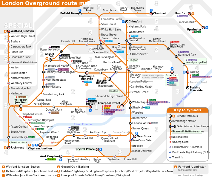
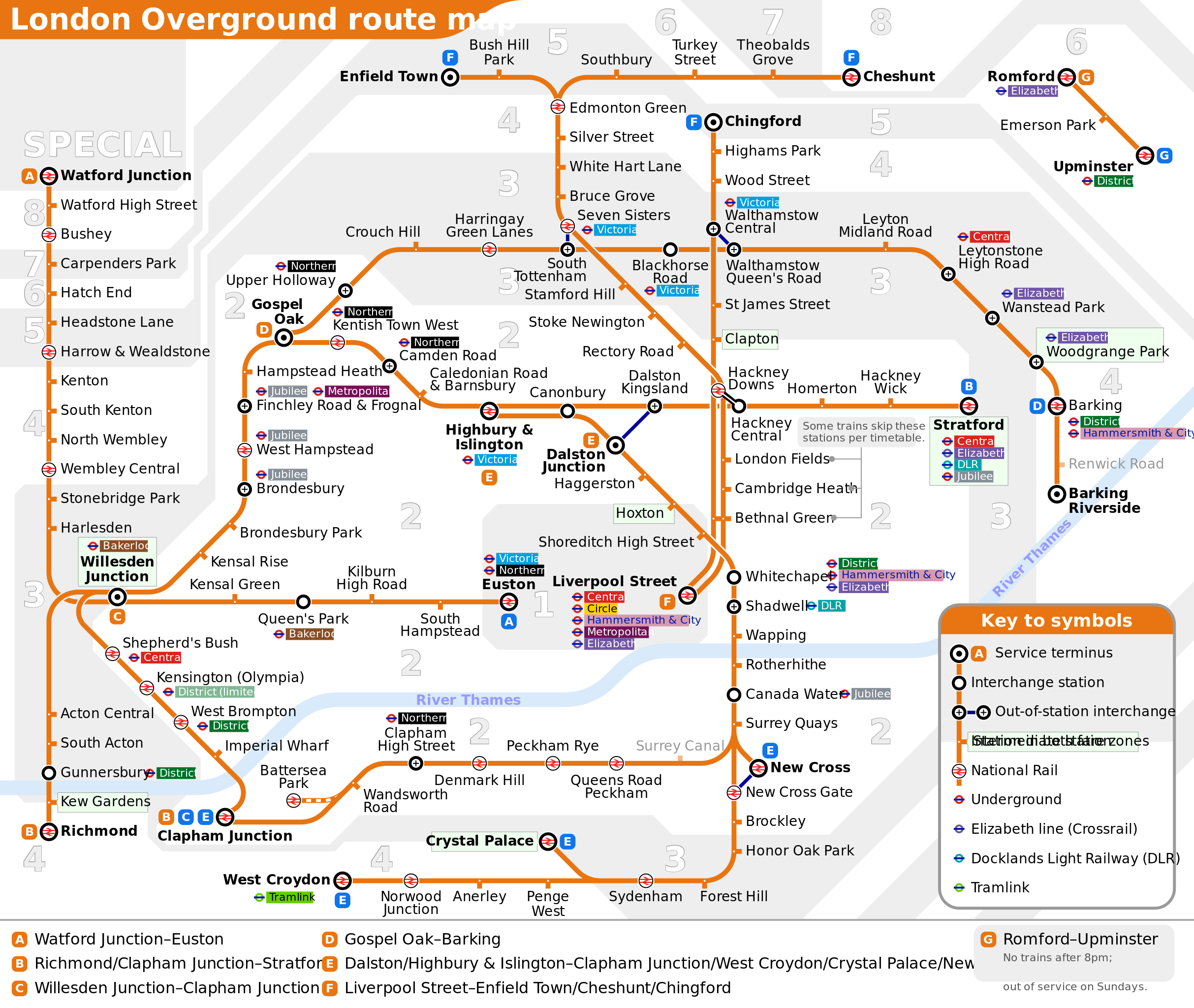
English: London Overground topological network map. Letters designated to routes are not official, these are applied by the author for easier identification in this map only. The SVG source provides a switch for hiding/showing the fare zones in the background. Clicking the line or the line name in the key will highlight the line in question in blue. This effect can be cancelled globally by clicking the background/fare zones. These functions are not available to the PNG or PDF versions.
|
|||||
| ⧼wm-license-information-date⧽ | قالب:Upload date | |||||
| ⧼wm-license-information-source⧽ | ⧼Wm-license-own-work⧽ | |||||
| ⧼wm-license-information-author⧽ | user:Sameboat | |||||
| ⧼wm-license-information-permission⧽ (⧼wm-license-information-permission-reusing-text⧽) |
|
|||||
| ⧼wm-license-information-other-versions⧽ |
قالب:PDF version available |

تاريخ الملف
اضغط على زمن/تاريخ لرؤية الملف كما بدا في هذا الزمن.
| زمن/تاريخ | صورة مصغرة | الأبعاد | مستخدم | تعليق | |
|---|---|---|---|---|---|
| حالي | ★ مراجعة معتمدة 11:29، 14 أكتوبر 2023 | | 1٬220 × 1٬030 (52 كيلوبايت) | Pastakhov (نقاش | مساهمات) | Upload https://upload.wikimedia.org/wikipedia/commons/d/de/London_Overground_map_sb.svg |
لا يمكنك استبدال هذا الملف.
وصلات
لا يوجد صفحات تصل لهذه الصورة.