ملف:Locator Kota Tangerang Selatan.png
حجم هذه المعاينة: 800 × 577 بكسل. البعد الآخر: 801 × 578 بكسل.
الملف الأصلي (801 × 578 بكسل حجم الملف: 48 كيلوبايت، نوع MIME: image/png)
وصف قصير
| ⧼wm-license-information-description⧽ |
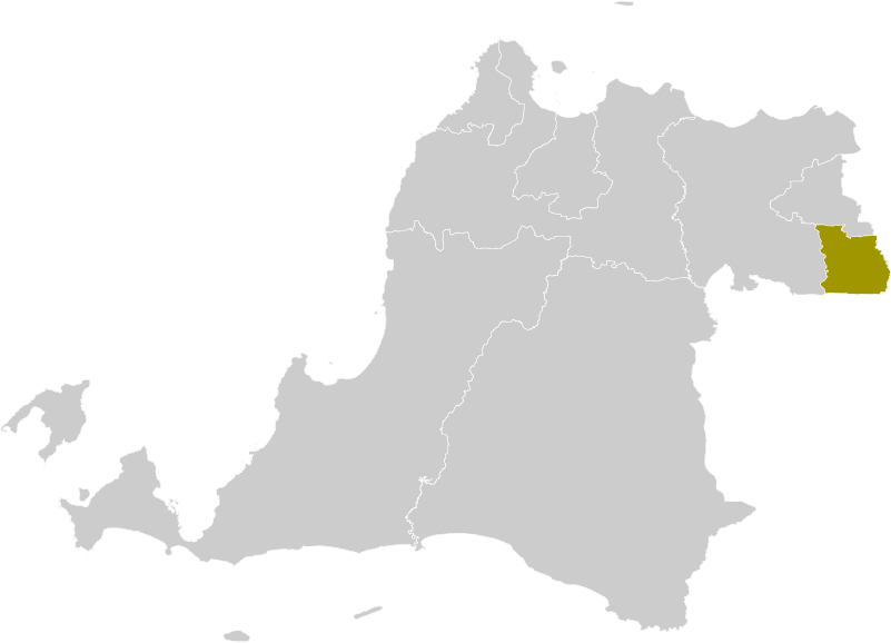
Locator map of South Tangerang Municipality |
| ⧼wm-license-information-date⧽ | 2012-10-11 18:39 (UTC) |
| ⧼wm-license-information-source⧽ | قالب:Derived from |
| ⧼wm-license-information-author⧽ |
|
| ⧼wm-license-information-other-versions⧽ |
| [This is a retouched picture, which means that it has been digitally altered from its original version. Modifications: new municipal border added. The original can be viewed here: Locator_Kabupaten_Serang.png. Modifications made by Topographie.] Error: {{Lang}}: text has italic markup (help)
|
ترخيص
|
قالب:Original upload log
This image is a derivative work of the following images:
- File:Locator_Kabupaten_Serang.png licensed with Cc-by-sa-3.0
- 2012-10-11T00:48:45Z OgreBot 245x161 (4306 Bytes) (BOT): Reverting to most recent version before archival
- 2012-10-11T00:48:41Z OgreBot 245x161 (4223 Bytes) (BOT): Uploading old version of file from en.wikipedia; originally uploaded on 2011-12-12 11:03:22 by [[en:User:Doseiai2|Doseiai2]]
- 2012-10-11T00:48:36Z OgreBot 245x161 (4176 Bytes) (BOT): Uploading old version of file from en.wikipedia; originally uploaded on 2011-12-12 10:42:58 by [[en:User:Doseiai2|Doseiai2]]
- 2012-10-10T23:17:44Z File Upload Bot (Magnus Manske) 245x161 (4306 Bytes) Transfered from en.wikipedia by [[User:Topographie]] using CommonsHelper
تاريخ الملف
اضغط على زمن/تاريخ لرؤية الملف كما بدا في هذا الزمن.
| زمن/تاريخ | صورة مصغرة | الأبعاد | مستخدم | تعليق | |
|---|---|---|---|---|---|
| حالي | ★ مراجعة معتمدة 05:32، 28 أكتوبر 2023 | | 801 × 578 (48 كيلوبايت) | Pastakhov (نقاش | مساهمات) | Upload https://upload.wikimedia.org/wikipedia/commons/1/16/Locator_Kota_Tangerang_Selatan.png |
لا يمكنك استبدال هذا الملف.
وصلات
لا يوجد صفحات تصل لهذه الصورة.