ملف:Locator County of Holland (1350).svg

حجم معاينة PNG لذلك الملف ذي الامتداد SVG: 468 × 599 بكسل. البعد الآخر: 1٬599 × 2٬048 بكسل.
الملف الأصلي (ملف SVG، أبعاده 2٬818 × 3٬608 بكسل، حجم الملف: 427 كيلوبايت)
وصف قصير
| ⧼wm-license-information-description⧽ |
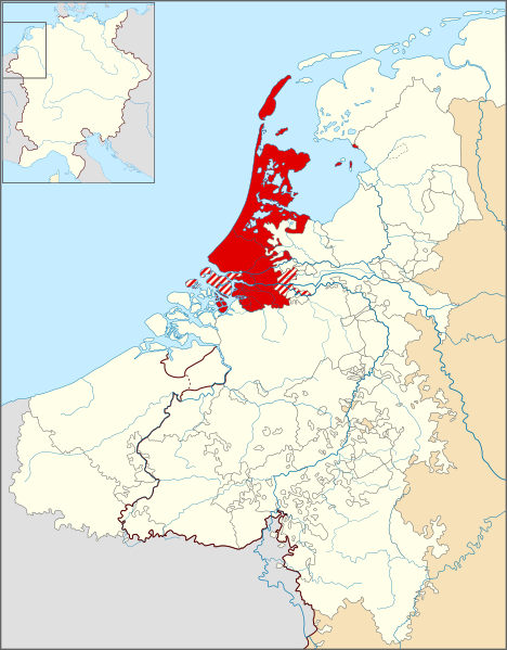
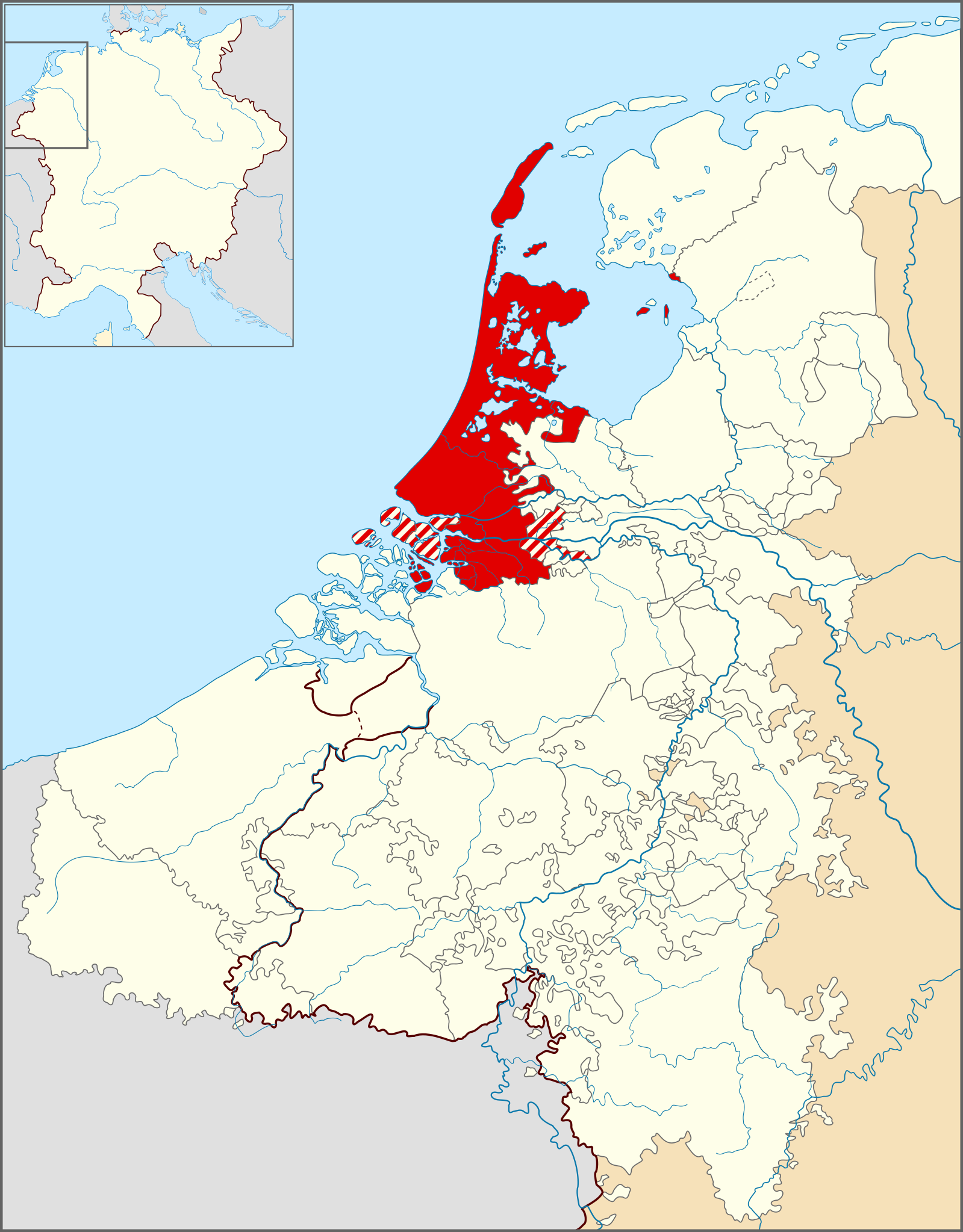
English: Locator map of the en:County of Holland in 1350. (Dutch)
|
| ⧼wm-license-information-date⧽ | 2011 |
| ⧼wm-license-information-source⧽ | Based on the map 'Lage landen omsteeks 1350' in the De bosatlas van de geschiedenis van Nederland, p. 145 (2011). |
| ⧼wm-license-information-author⧽ | Sir Iain |
ترخيص
|
تاريخ الملف
اضغط على زمن/تاريخ لرؤية الملف كما بدا في هذا الزمن.
| زمن/تاريخ | صورة مصغرة | الأبعاد | مستخدم | تعليق | |
|---|---|---|---|---|---|
| حالي | ★ مراجعة معتمدة 10:48، 18 أكتوبر 2023 | | 2٬818 × 3٬608 (427 كيلوبايت) | Pastakhov (نقاش | مساهمات) | Upload https://upload.wikimedia.org/wikipedia/commons/2/2a/Locator_County_of_Holland_%281350%29.svg |
لا يمكنك استبدال هذا الملف.
وصلات
لا يوجد صفحات تصل لهذه الصورة.
.svg&oldid=3171494)