ملف:Location map United States Manhattan SoHo.png

حجم هذه المعاينة: 336 × 600 بكسل. البعد الآخر: 492 × 878 بكسل.
الملف الأصلي (492 × 878 بكسل حجم الملف: 704 كيلوبايت، نوع MIME: image/png)
| ⧼wm-license-information-description⧽ |
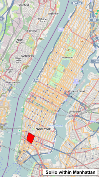
English: SoHo within the map of Manhattan Geographic limits of the map: * N: 40.8383° * S: 40.6909 * W: -74.0343° * E: -73.9252° قالب:CC-BY-SA 2.0
|
| ⧼wm-license-information-date⧽ | 2010-08-25 12:09 (UTC) |
| ⧼wm-license-information-source⧽ | |
| ⧼wm-license-information-author⧽ |
|
| [This is a retouched picture, which means that it has been digitally altered from its original version. Modifications: colored the SoHo. The original can be viewed here: _Location_map_United_States_Manhattan.png. Modifications made by MrPanyGoff.] Error: {{Lang}}: text has italic markup (help)
|
قالب:Original upload log
This image is a derivative work of the following images:
- File:_Location_map_United_States_Manhattan.png licensed with Cc-by-sa-2.0
- 2010-05-02T19:14:23Z Dr. Blofeld 394x703 (395216 Bytes) {{Information |Description={{en|1=l}} |Source=l |Author=k |Date=l |Permission= |other_versions= }} l
تاريخ الملف
اضغط على زمن/تاريخ لرؤية الملف كما بدا في هذا الزمن.
| زمن/تاريخ | صورة مصغرة | الأبعاد | مستخدم | تعليق | |
|---|---|---|---|---|---|
| حالي | ★ مراجعة معتمدة 08:51، 12 نوفمبر 2023 | | 492 × 878 (704 كيلوبايت) | Pastakhov (نقاش | مساهمات) | Upload https://upload.wikimedia.org/wikipedia/commons/1/10/Location_map_United_States_Manhattan_SoHo.png |
لا يمكنك استبدال هذا الملف.
وصلات
لا يوجد صفحات تصل لهذه الصورة.