ملف:Lippe innerhalb der britischen Besatzungszone 1946.svg

حجم معاينة PNG لذلك الملف ذي الامتداد SVG: 492 × 600 بكسل. البعد الآخر: 1٬680 × 2٬048 بكسل.
الملف الأصلي (ملف SVG، أبعاده 512 × 624 بكسل، حجم الملف: 454 كيلوبايت)
وصف قصير
| ⧼wm-license-information-description⧽ |
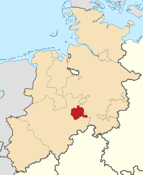
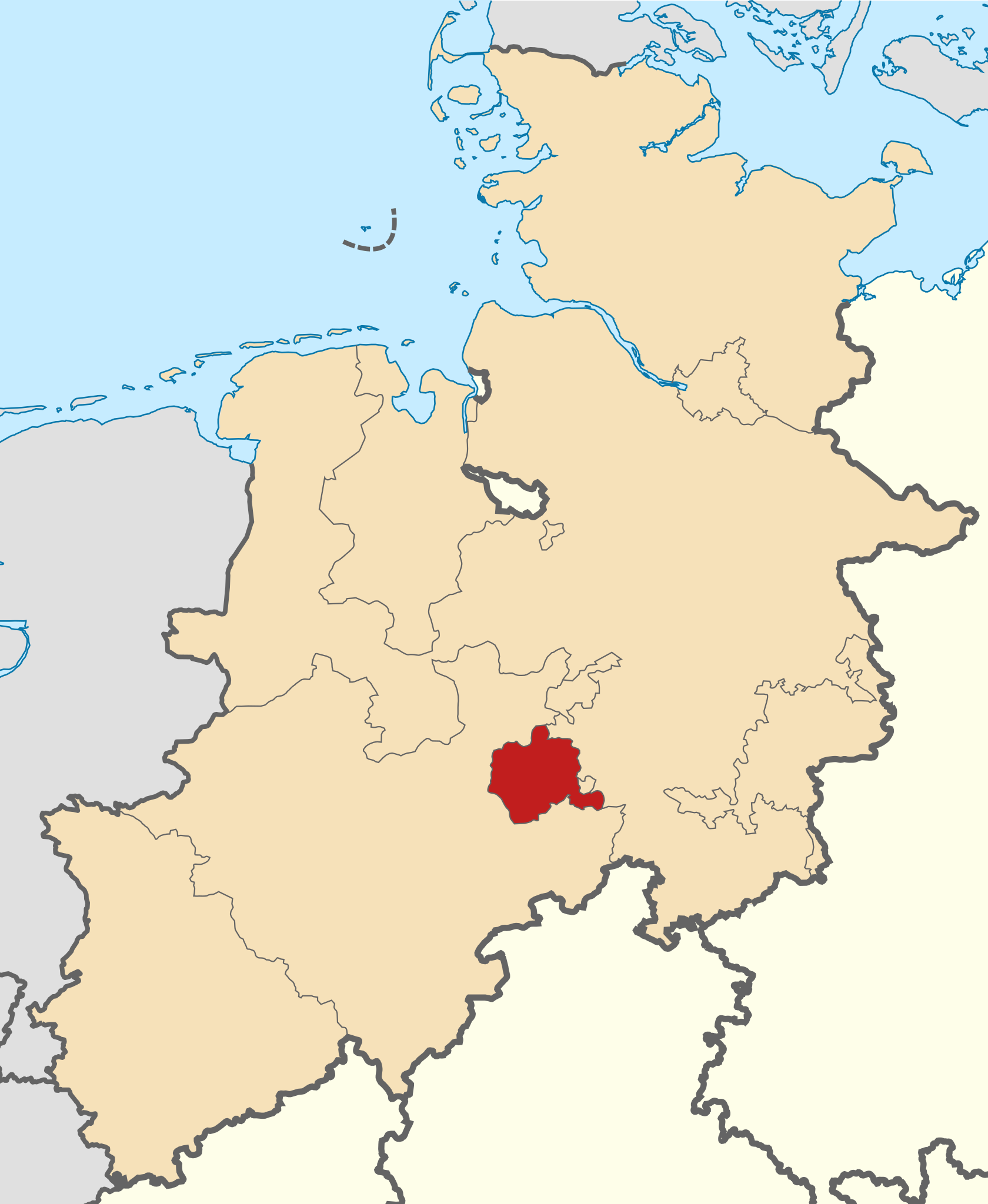
Deutsch: Karte des Freistaats Lippe Hannover innerhalb der britischen Besatzungszone, Stand: 1. Januar 1946, mit heutigem Küstenverlauf
English: Map of Lippe in the British Zone of Occupation
|
| ⧼wm-license-information-date⧽ | 2016 |
| ⧼wm-license-information-source⧽ | ⧼Wm-license-own-work⧽ قالب:Derived from |
| ⧼wm-license-information-author⧽ | Aeroid |
| ⧼wm-license-information-other-versions⧽ |
File:Nordrhein-Westfalen-Lippe innerhalb der britischen Besatzungszone 1946.svg |
ترخيص
|
تاريخ الملف
اضغط على زمن/تاريخ لرؤية الملف كما بدا في هذا الزمن.
| زمن/تاريخ | صورة مصغرة | الأبعاد | مستخدم | تعليق | |
|---|---|---|---|---|---|
| حالي | ★ مراجعة معتمدة 07:22، 2 ديسمبر 2023 | | 512 × 624 (454 كيلوبايت) | Pastakhov (نقاش | مساهمات) | Upload https://upload.wikimedia.org/wikipedia/commons/5/56/Lippe_innerhalb_der_britischen_Besatzungszone_1946.svg |
لا يمكنك استبدال هذا الملف.
وصلات
لا يوجد صفحات تصل لهذه الصورة.