ملف:Limes Rhin.png
حجم هذه المعاينة: 495 × 599 بكسل. البعد الآخر: 748 × 905 بكسل.
الملف الأصلي (748 × 905 بكسل حجم الملف: 143 كيلوبايت، نوع MIME: image/png)
وصف قصير
| ⧼wm-license-information-description⧽ |
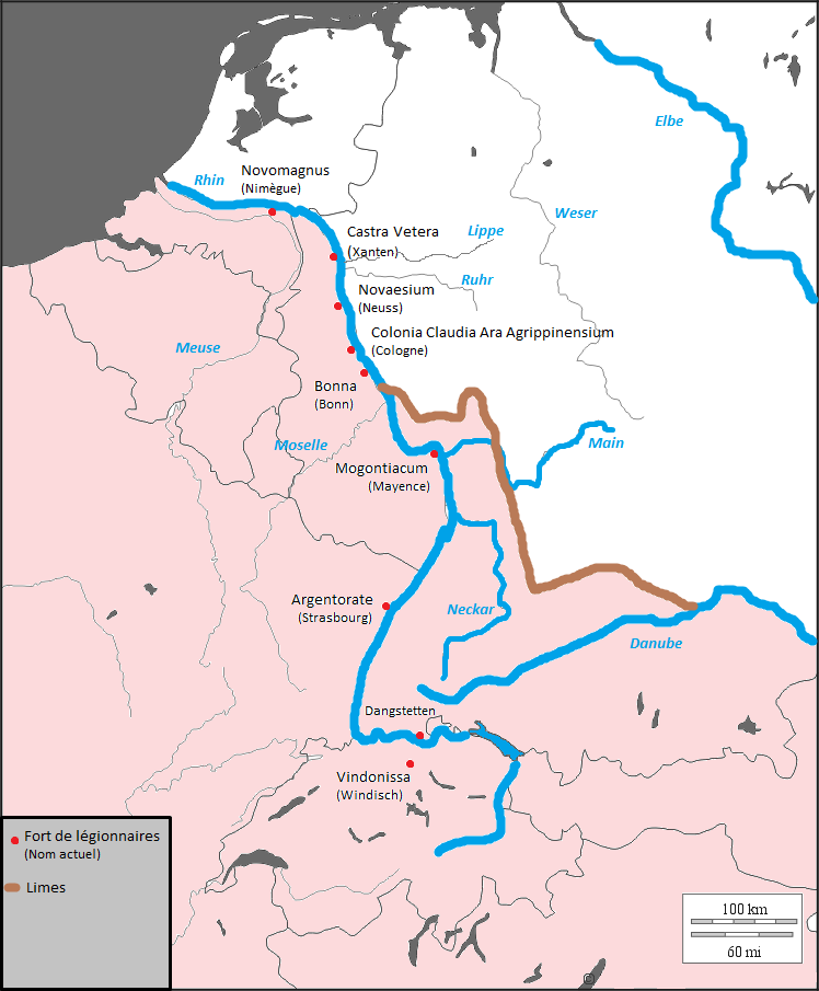
English: Location of the German Limes in connection with the present borders of states
Français : Localisation du Limès germanique en rapport avec les frontières actuelles des états
|
| ⧼wm-license-information-date⧽ | 2009 |
| ⧼wm-license-information-source⧽ | http://histgeo.ac-aix-marseille.fr/webphp/carte.php?num_car=2054&lang=fr |
| ⧼wm-license-information-author⧽ | Thioneb |
| ⧼wm-license-information-permission⧽ (⧼wm-license-information-permission-reusing-text⧽) |
Fond provenant du fonds de cartes libres du département d'histoire-géographie de l'académie d'aix-marseille |
ترخيص
تاريخ الملف
اضغط على زمن/تاريخ لرؤية الملف كما بدا في هذا الزمن.
| زمن/تاريخ | صورة مصغرة | الأبعاد | مستخدم | تعليق | |
|---|---|---|---|---|---|
| حالي | ★ مراجعة معتمدة 00:20، 25 أكتوبر 2023 | | 748 × 905 (143 كيلوبايت) | Pastakhov (نقاش | مساهمات) | Upload https://upload.wikimedia.org/wikipedia/commons/8/83/Limes_Rhin.png |
لا يمكنك استبدال هذا الملف.
وصلات
لا يوجد صفحات تصل لهذه الصورة.