ملف:Limerick Dáil constituency 2011.png

حجم هذه المعاينة: 471 × 600 بكسل. البعد الآخر: 696 × 886 بكسل.
الملف الأصلي (696 × 886 بكسل حجم الملف: 47 كيلوبايت، نوع MIME: image/png)
وصف قصير
| ⧼wm-license-information-description⧽ |
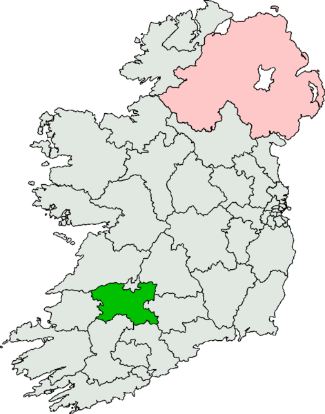
English: Map depicting the Irish electoral constituency of Limerick, created under the Electoral Act 2009.
|
| ⧼wm-license-information-date⧽ | 2010 |
| ⧼wm-license-information-source⧽ | ⧼Wm-license-own-work⧽ - adapted from public domain map of 2011 Irish constituencies found at http://en.wikipedia.org/wiki/File:Irish_constituencies.svg, uploaded by User:Barryrob |
| ⧼wm-license-information-author⧽ | JandK87 |
| ⧼wm-license-information-permission⧽ (⧼wm-license-information-permission-reusing-text⧽) |
Public domain. |
ترخيص
تاريخ الملف
اضغط على زمن/تاريخ لرؤية الملف كما بدا في هذا الزمن.
| زمن/تاريخ | صورة مصغرة | الأبعاد | مستخدم | تعليق | |
|---|---|---|---|---|---|
| حالي | ★ مراجعة معتمدة 23:51، 6 نوفمبر 2023 | | 696 × 886 (47 كيلوبايت) | Pastakhov (نقاش | مساهمات) | Upload https://upload.wikimedia.org/wikipedia/commons/4/47/Limerick_D%C3%A1il_constituency_2011.png |
لا يمكنك استبدال هذا الملف.
وصلات
لا يوجد صفحات تصل لهذه الصورة.