ملف:Lenzfried alte Flurkarte.png
حجم هذه المعاينة: 800 × 467 بكسل. البعد الآخر: 1٬470 × 859 بكسل.
الملف الأصلي (1٬470 × 859 بكسل حجم الملف: 2٫6 ميجابايت، نوع MIME: image/png)
وصف قصير
| ⧼wm-license-information-description⧽ |
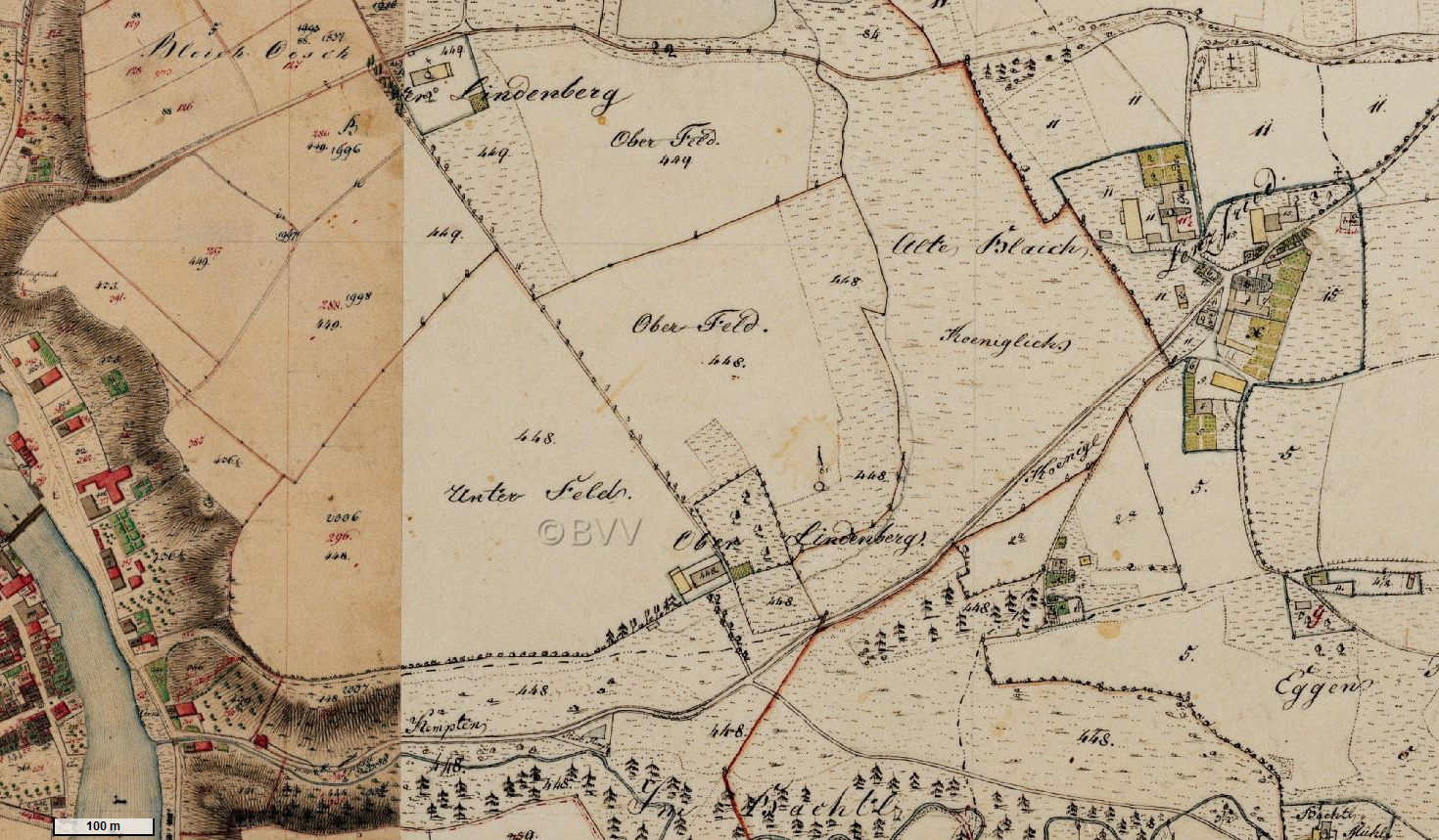
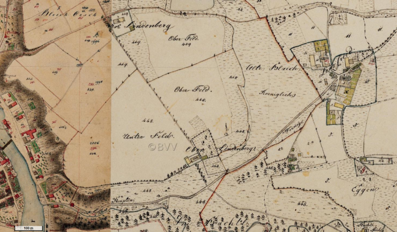
Deutsch: Erste Flurkarte 1:5000 von Bayern. Hier Lenzfried rechts oben. Rot ist die ursprüngliche Stadtgrenze von Kempten.
|
| ⧼wm-license-information-date⧽ | between 1808 and 1854 (1823?) |
| ⧼wm-license-information-source⧽ | http://geoportal.bayern.de/bayernatlas/?lon=4374841.5&lat=5288891.0&zoom=12&base=952 |
| ⧼wm-license-information-author⧽ | Steuerrektifikationskommission (Königliche unmittelbare Steuerkommission) |
ترخيص
|
|
This file is in the ملكية عامة because its copyright has expired in the United States and those countries with a copyright term of no more than the life of the author plus 100 years.
|
تاريخ الملف
اضغط على زمن/تاريخ لرؤية الملف كما بدا في هذا الزمن.
| زمن/تاريخ | صورة مصغرة | الأبعاد | مستخدم | تعليق | |
|---|---|---|---|---|---|
| حالي | ★ مراجعة معتمدة 15:02، 30 نوفمبر 2023 | | 1٬470 × 859 (2٫6 ميجابايت) | Pastakhov (نقاش | مساهمات) | Upload https://upload.wikimedia.org/wikipedia/commons/d/d4/Lenzfried_alte_Flurkarte.png |
لا يمكنك استبدال هذا الملف.
وصلات
لا يوجد صفحات تصل لهذه الصورة.