ملف:Le Saix-77.JPG

حجم هذه المعاينة: 800 × 564 بكسل. البعد الآخر: 1٬120 × 790 بكسل.
الملف الأصلي (1٬120 × 790 بكسل حجم الملف: 415 كيلوبايت، نوع MIME: image/jpeg)
وصف قصير
| ⧼wm-license-information-description⧽ |
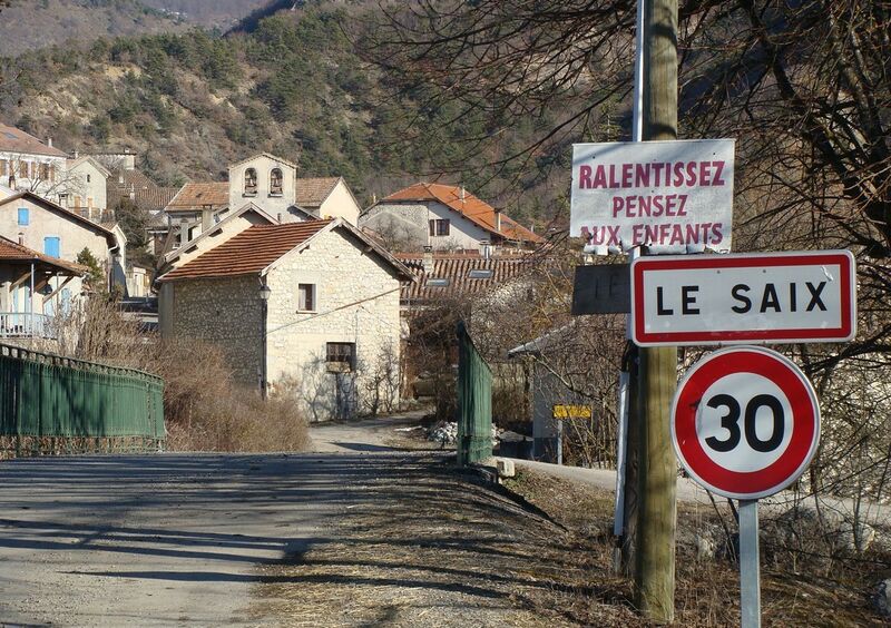
Français : Le Saix (Hautes-Alpes), l'entrée du village sur la D49, venant de Chabestan. Vue vers l'Est. Le pont enjambe le torrent du Poutelier, venant du nord. Au milieu du village on voit le haut du mur de façade de l'église Saint-Vincent, avec ses deux cloches. En arrière-plan, les contreforts du Pibonnet (1267 m d'altitude, hors photo) surplombant la vallée du ruisseau de la Garenne.
|
| ⧼wm-license-information-date⧽ | 2012 |
| ⧼wm-license-information-source⧽ | ⧼Wm-license-own-work⧽ |
| ⧼wm-license-information-author⧽ | Fr.Latreille |
ترخيص
|
تاريخ الملف
اضغط على زمن/تاريخ لرؤية الملف كما بدا في هذا الزمن.
| زمن/تاريخ | صورة مصغرة | الأبعاد | مستخدم | تعليق | |
|---|---|---|---|---|---|
| حالي | ★ مراجعة معتمدة 14:39، 23 أكتوبر 2023 | | 1٬120 × 790 (415 كيلوبايت) | Pastakhov (نقاش | مساهمات) | Upload https://upload.wikimedia.org/wikipedia/commons/4/42/Le_Saix-77.JPG |
لا يمكنك استبدال هذا الملف.
وصلات
لا يوجد صفحات تصل لهذه الصورة.