ملف:Landsat art - Great Sandy Desert, Australia.jpg
حجم هذه المعاينة: 600 × 600 بكسل. البعدان الآخران: 2٬048 × 2٬048 بكسل | 3٬600 × 3٬600 بكسل.
الملف الأصلي (3٬600 × 3٬600 بكسل حجم الملف: 3٫59 ميجابايت، نوع MIME: image/jpeg)
| ⧼wm-license-information-description⧽ |
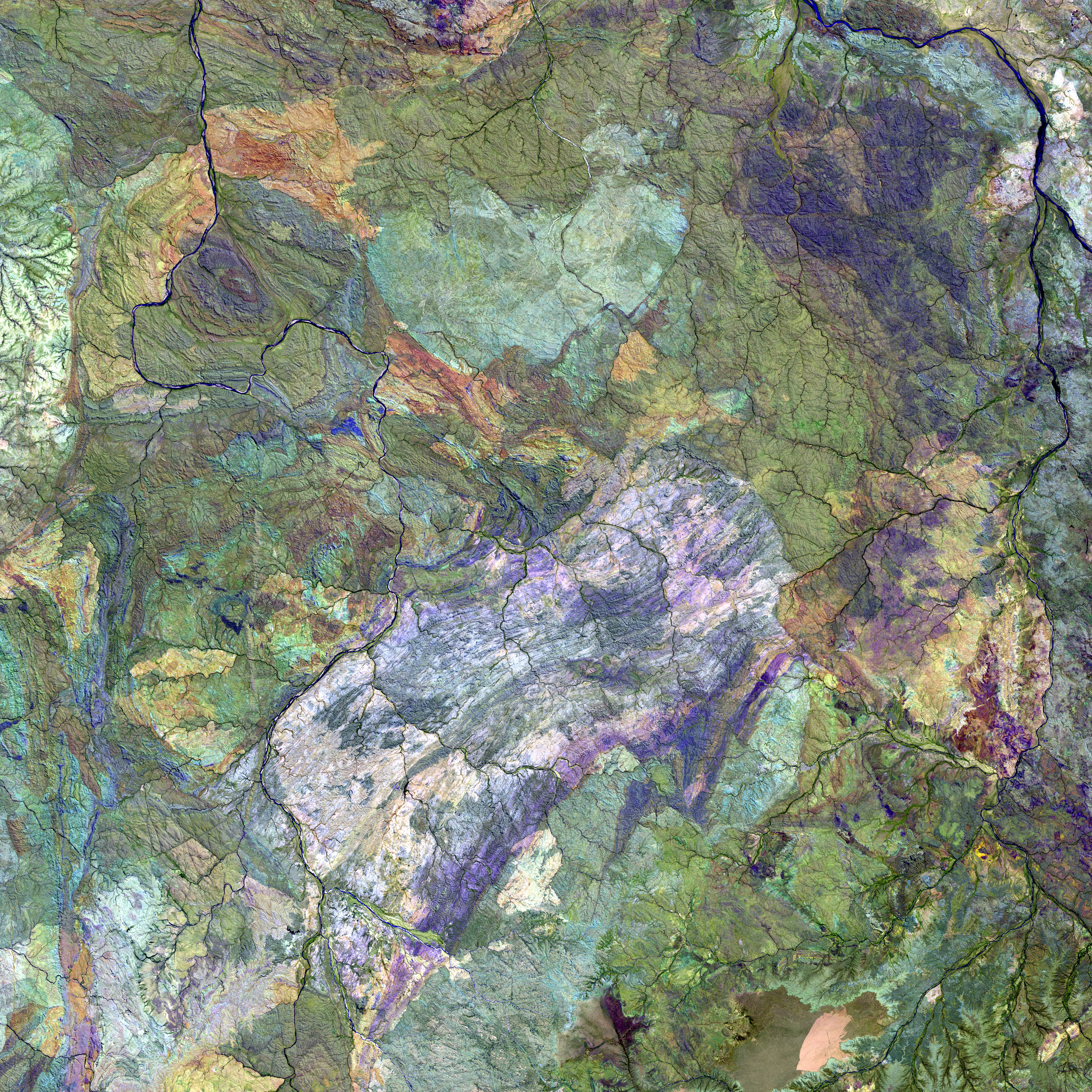
English: Great Sandy Desert, Australia. – The western region of Australia’s Great Sandy Desert is in an area almost devoid of sand, but characterized by complex geology. This is a false-color composite image made using shortwave-infrared, infrared, and red wavelengths.
|
| ⧼wm-license-information-date⧽ | This image was acquired on February 24, 2001. |
| ⧼wm-license-information-source⧽ | http://earthobservatory.nasa.gov/Newsroom/NewImages/images.php3?img_id=10815 Image provided by the USGS EROS Data Center Satellite Systems Branch. |
| ⧼wm-license-information-author⧽ | This image was acquired by Landsat 7’s Enhanced Thematic Mapper plus (ETM+) sensor. |
| ⧼wm-license-information-permission⧽ (⧼wm-license-information-permission-reusing-text⧽) |
public domain |
تاريخ الملف
اضغط على زمن/تاريخ لرؤية الملف كما بدا في هذا الزمن.
| زمن/تاريخ | صورة مصغرة | الأبعاد | مستخدم | تعليق | |
|---|---|---|---|---|---|
| حالي | ★ مراجعة معتمدة 13:12، 13 أكتوبر 2023 | | 3٬600 × 3٬600 (3٫59 ميجابايت) | Pastakhov (نقاش | مساهمات) | Upload https://upload.wikimedia.org/wikipedia/commons/8/84/Landsat_art_-_Great_Sandy_Desert%2C_Australia.jpg |
لا يمكنك استبدال هذا الملف.
وصلات
لا يوجد صفحات تصل لهذه الصورة.