ملف:Kuk New Guinea 2002.jpg

حجم هذه المعاينة: 758 × 600 بكسل. البعدان الآخران: 2٬560 × 2٬026 بكسل | 2٬664 × 2٬108 بكسل.
الملف الأصلي (2٬664 × 2٬108 بكسل حجم الملف: 1٫27 ميجابايت، نوع MIME: image/jpeg)
وصف قصير
| ⧼wm-license-information-description⧽ |
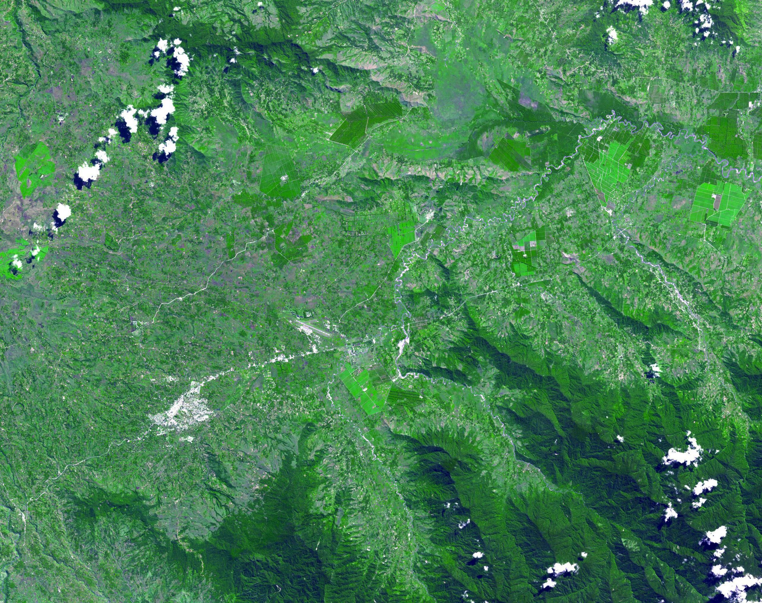
English: The Kuk Early Agricultural Site consists of 116 ha of swamps in the western highlands of New Guinea 1,500 meters above sea-level. Archaeological excavation has revealed the landscape to be one of wetland reclamation worked almost continuously for 7,000, and possibly for 10,000 years. The area was declared a UNESCO World Heritage Site in 2008. The image was acquired May 7, 2002, covers an area of 31.6 x 40 km, and is located at 5.8° S, 144.3° E.
|
| ⧼wm-license-information-date⧽ | 2002 |
| ⧼wm-license-information-source⧽ | http://photojournal.jpl.nasa.gov/catalog/PIA13090 |
| ⧼wm-license-information-author⧽ | NASA: JPL |
ترخيص
تاريخ الملف
اضغط على زمن/تاريخ لرؤية الملف كما بدا في هذا الزمن.
| زمن/تاريخ | صورة مصغرة | الأبعاد | مستخدم | تعليق | |
|---|---|---|---|---|---|
| حالي | ★ مراجعة معتمدة 20:27، 12 أكتوبر 2023 | | 2٬664 × 2٬108 (1٫27 ميجابايت) | Pastakhov (نقاش | مساهمات) | Upload https://upload.wikimedia.org/wikipedia/commons/7/7a/Kuk_New_Guinea_2002.jpg |
لا يمكنك استبدال هذا الملف.
وصلات
لا يوجد صفحات تصل لهذه الصورة.