ملف:Kievan Rus in 1237 (en).svg

حجم معاينة PNG لذلك الملف ذي الامتداد SVG: 553 × 600 بكسل. البعد الآخر: 1٬888 × 2٬048 بكسل.
الملف الأصلي (ملف SVG، أبعاده 1٬204 × 1٬306 بكسل، حجم الملف: 332 كيلوبايت)
وصف قصير
قالب:Igen
| ⧼wm-license-information-description⧽ |
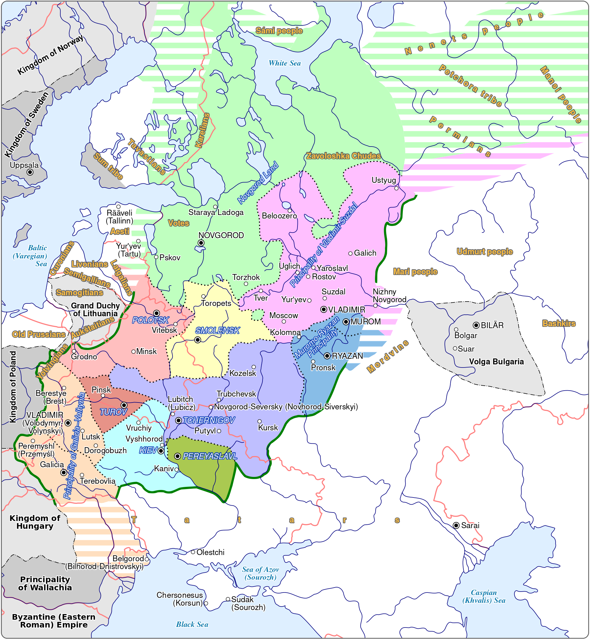
English: Map of the Kievan Rus in 1237. The names of tribes and peoples are in bold and yellow, the names of countries outside the Kievan Rus are in bold and black. The names of principalities of the Kievan Rus are in blue; if a principality bears a name which comes directly from the name of its capital (e.g. the Principality of Kiev), the complete name of the principalty is not on the map and the name of the capital is in blue.
|
||
| ⧼wm-license-information-date⧽ | 2020 | ||
| ⧼wm-license-information-source⧽ | ⧼Wm-license-own-work⧽ قالب:Derived from Information from: |
||
| ⧼wm-license-information-author⧽ | Goran tek-en, following request by and knowledge from Veverve | ||
| ⧼wm-license-information-permission⧽ (⧼wm-license-information-permission-reusing-text⧽) |
|
||
| ⧼wm-license-information-other-versions⧽ |
تاريخ الملف
اضغط على زمن/تاريخ لرؤية الملف كما بدا في هذا الزمن.
| زمن/تاريخ | صورة مصغرة | الأبعاد | مستخدم | تعليق | |
|---|---|---|---|---|---|
| حالي | ★ مراجعة معتمدة 02:38، 30 أكتوبر 2023 | | 1٬204 × 1٬306 (332 كيلوبايت) | Pastakhov (نقاش | مساهمات) | Upload https://upload.wikimedia.org/wikipedia/commons/e/e7/Kievan_Rus_in_1237_%28en%29.svg |
لا يمكنك استبدال هذا الملف.
وصلات
لا يوجد صفحات تصل لهذه الصورة.
.svg&oldid=3292788)