ملف:Kharkova flowpath.jpg
حجم هذه المعاينة: 800 × 486 بكسل. البعد الآخر: 1٬395 × 848 بكسل.
الملف الأصلي (1٬395 × 848 بكسل حجم الملف: 238 كيلوبايت، نوع MIME: image/jpeg)
وصف قصير
| ⧼wm-license-information-description⧽ |
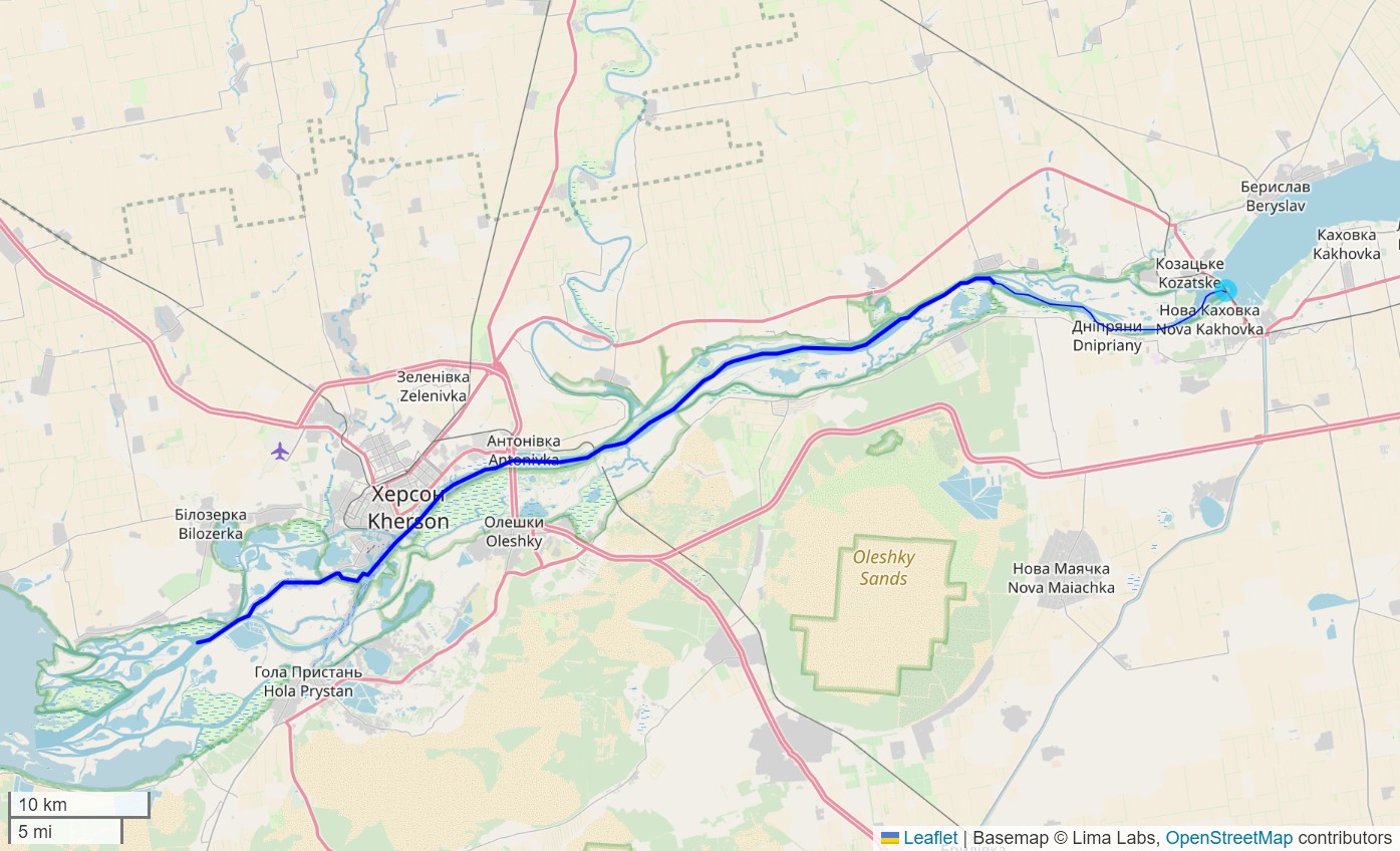
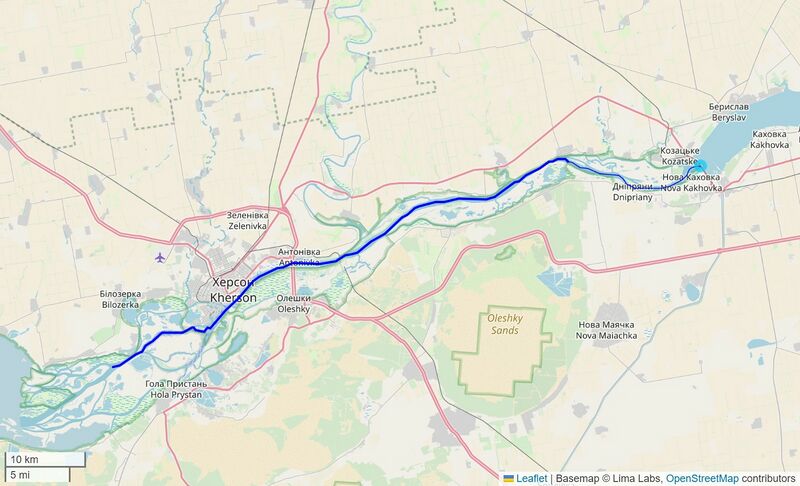
English: Flow path along the Dnipr River downstream of the Nova Kakhovka Dam. Interactive map available at: https://mghydro.com/watersheds/shared/8071A4.html
|
| ⧼wm-license-information-date⧽ | 2023 |
| ⧼wm-license-information-source⧽ | ⧼Wm-license-own-work⧽ |
| ⧼wm-license-information-author⧽ | Mheberger |
ترخيص
|
تاريخ الملف
اضغط على زمن/تاريخ لرؤية الملف كما بدا في هذا الزمن.
| زمن/تاريخ | صورة مصغرة | الأبعاد | مستخدم | تعليق | |
|---|---|---|---|---|---|
| حالي | ★ مراجعة معتمدة 20:48، 11 نوفمبر 2023 | | 1٬395 × 848 (238 كيلوبايت) | Pastakhov (نقاش | مساهمات) | Upload https://upload.wikimedia.org/wikipedia/commons/6/6e/Kharkova_flowpath.jpg |
لا يمكنك استبدال هذا الملف.
وصلات
لا يوجد صفحات تصل لهذه الصورة.