ملف:Kharan Map.gif
لا توجد دقة أعلى متوفرة.
Kharan_Map.gif (700 × 600 بكسل حجم الملف: 11 كيلوبايت، نوع MIME: image/gif)
وصف قصير
| ⧼wm-license-information-description⧽ |
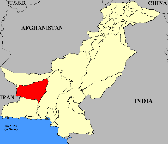
English: This map shows the relative position of the former State of Kharan up to its dissolution in 1955.
|
| ⧼wm-license-information-date⧽ | قالب:Original upload date |
| ⧼wm-license-information-source⧽ | قالب:Transferred from |
| ⧼wm-license-information-author⧽ | قالب:User at project |
ترخيص
|
قالب:Original upload log
- 2006-02-05 23:30 Green Giant 700×600× (11524 bytes) == Summary == This map shows the relative position of the former [[State of Kharan]] up to its dissolution in 1955. == Licencing == {{PD-self|Green_Giant}}
تاريخ الملف
اضغط على زمن/تاريخ لرؤية الملف كما بدا في هذا الزمن.
| زمن/تاريخ | صورة مصغرة | الأبعاد | مستخدم | تعليق | |
|---|---|---|---|---|---|
| حالي | ★ مراجعة معتمدة 15:01، 13 أكتوبر 2023 | | 700 × 600 (11 كيلوبايت) | Pastakhov (نقاش | مساهمات) | Upload https://upload.wikimedia.org/wikipedia/commons/9/9c/Kharan_Map.gif |
لا يمكنك استبدال هذا الملف.
وصلات
لا يوجد صفحات تصل لهذه الصورة.