ملف:Kentucky and Barkley Lakes aerial view.jpg
حجم هذه المعاينة: 800 × 533 بكسل. البعد الآخر: 1٬500 × 1٬000 بكسل.
الملف الأصلي (1٬500 × 1٬000 بكسل حجم الملف: 448 كيلوبايت، نوع MIME: image/jpeg)
| ⧼wm-license-information-description⧽ |
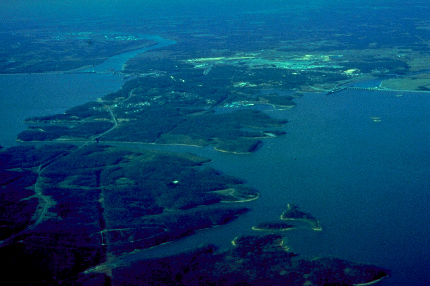
English: Aerial view of Kentucky Lake and Lake Barkley in Kentucky, USA. Kentucky Lake is on the left and Lake Barkley is on the right. Kentucky Lake was created by a dam on the Tennessee River. Kentucky Dam and Lock can be seen at the upper left in the photo. Barkley Lake was created by a dam on the Cumberland River. Barkley Dam and lock are visible at the upper right in the photo. At center-left in the picture can be seen a one-mile canal connecting the two lakes. The small town of Grand Rivers, Kentucky lies between the two dams. Between the two lakes lies the Land Between the Lakes National Recreaton Area.
|
| ⧼wm-license-information-date⧽ | not specified or unknown |
| ⧼wm-license-information-source⧽ | U.S. Army Corps of Engineers Digital Visual Library Image page Image description page Digital Visual Library home page |
| ⧼wm-license-information-author⧽ | George Green, U.S. Army Corps of Engineers |
| ⧼wm-license-information-permission⧽ (⧼wm-license-information-permission-reusing-text⧽) |
|
| قالب:Location/i18n | Grand Rivers, Kentucky, USA |
تاريخ الملف
اضغط على زمن/تاريخ لرؤية الملف كما بدا في هذا الزمن.
| زمن/تاريخ | صورة مصغرة | الأبعاد | مستخدم | تعليق | |
|---|---|---|---|---|---|
| حالي | ★ مراجعة معتمدة 12:16، 18 أكتوبر 2023 | | 1٬500 × 1٬000 (448 كيلوبايت) | Pastakhov (نقاش | مساهمات) | Upload https://upload.wikimedia.org/wikipedia/commons/6/6e/Kentucky_and_Barkley_Lakes_aerial_view.jpg |
لا يمكنك استبدال هذا الملف.
وصلات
لا يوجد صفحات تصل لهذه الصورة.