ملف:Karte des Allgäus.png
حجم هذه المعاينة: 739 × 599 بكسل. البعد الآخر: 1٬994 × 1٬617 بكسل.
الملف الأصلي (1٬994 × 1٬617 بكسل حجم الملف: 12٫32 ميجابايت، نوع MIME: image/png)
وصف قصير
| ⧼wm-license-information-description⧽ |
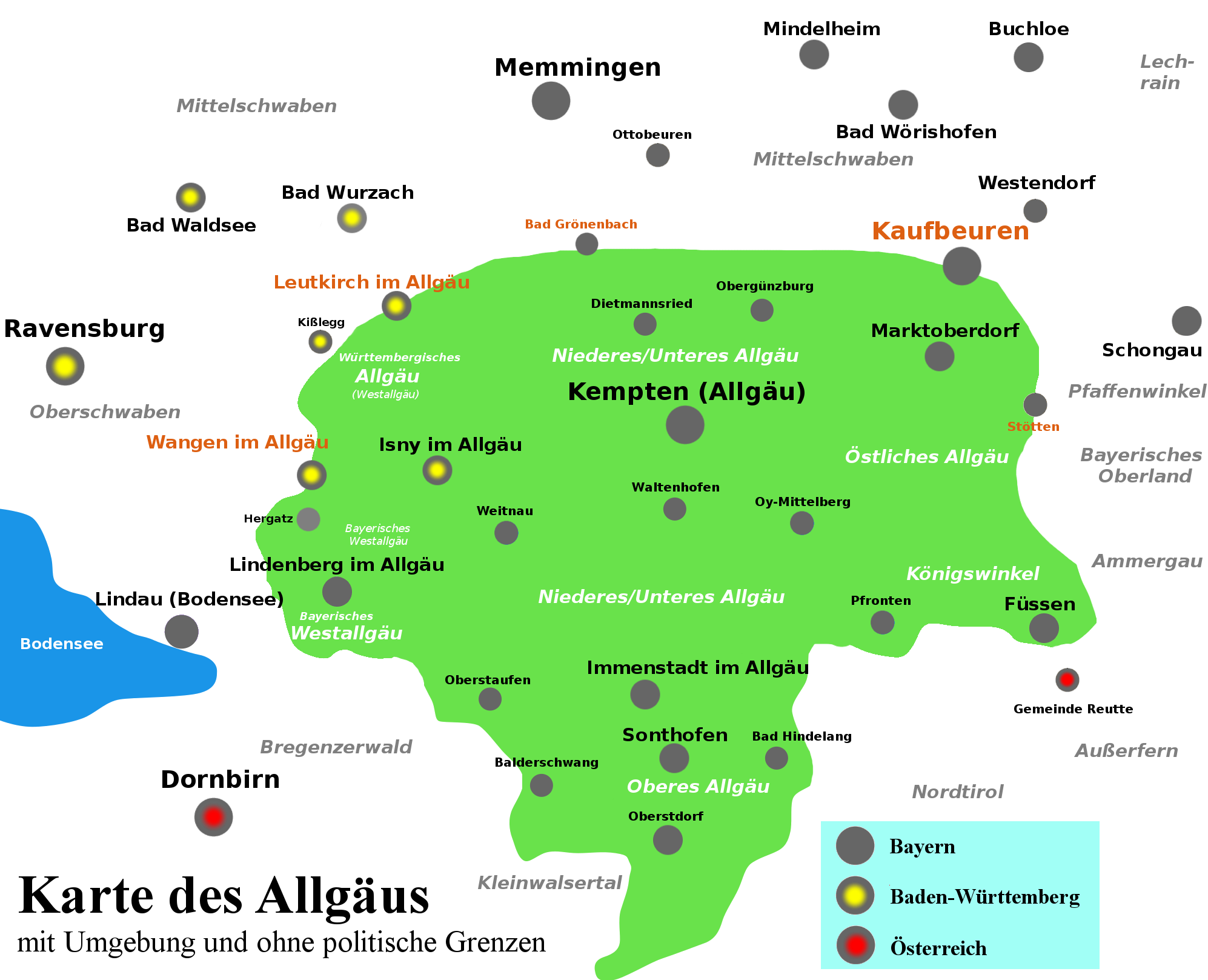
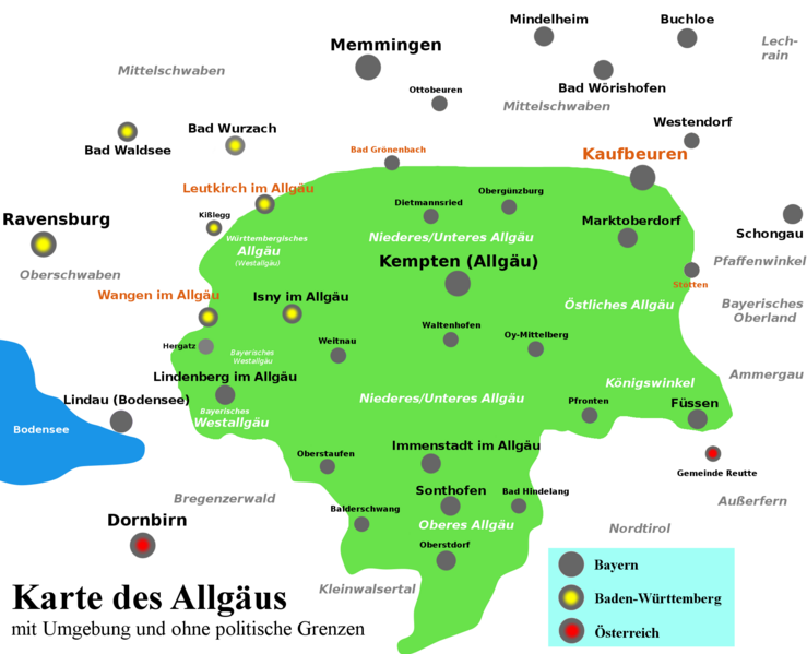
Deutsch: Lageplan/Karte des Allgäus anhand Ulrich Crämer/Philip Jakob Karrer/Otto Merkt (19. Jahrhundert/20. Jahrhundert). Der Ort Buchloe nennt sich erst in jüngerer Zeit (2000er) Tor zum Allgäu. Davor nannte sich Kaufbeuren lange Zeit Tor zum Allgäu.
|
| ⧼wm-license-information-date⧽ | 2018 |
| ⧼wm-license-information-source⧽ | ⧼Wm-license-own-work⧽ |
| ⧼wm-license-information-author⧽ | Hilarmont |
ترخيص
تاريخ الملف
اضغط على زمن/تاريخ لرؤية الملف كما بدا في هذا الزمن.
| زمن/تاريخ | صورة مصغرة | الأبعاد | مستخدم | تعليق | |
|---|---|---|---|---|---|
| حالي | ★ مراجعة معتمدة 16:43، 29 نوفمبر 2023 | | 1٬994 × 1٬617 (12٫32 ميجابايت) | Pastakhov (نقاش | مساهمات) | Upload https://upload.wikimedia.org/wikipedia/commons/d/d5/Karte_des_Allg%C3%A4us.png |
لا يمكنك استبدال هذا الملف.
وصلات
لا يوجد صفحات تصل لهذه الصورة.