ملف:Karte A Noe PL 2017.svg

حجم معاينة PNG لذلك الملف ذي الامتداد SVG: 649 × 600 بكسل. البعد الآخر: 2٬217 × 2٬048 بكسل.
الملف الأصلي (ملف SVG، أبعاده 1٬050 × 970 بكسل، حجم الملف: 56 كيلوبايت)
وصف قصير
| ⧼wm-license-information-description⧽ |
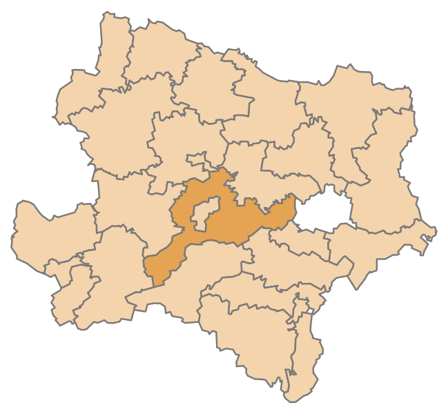
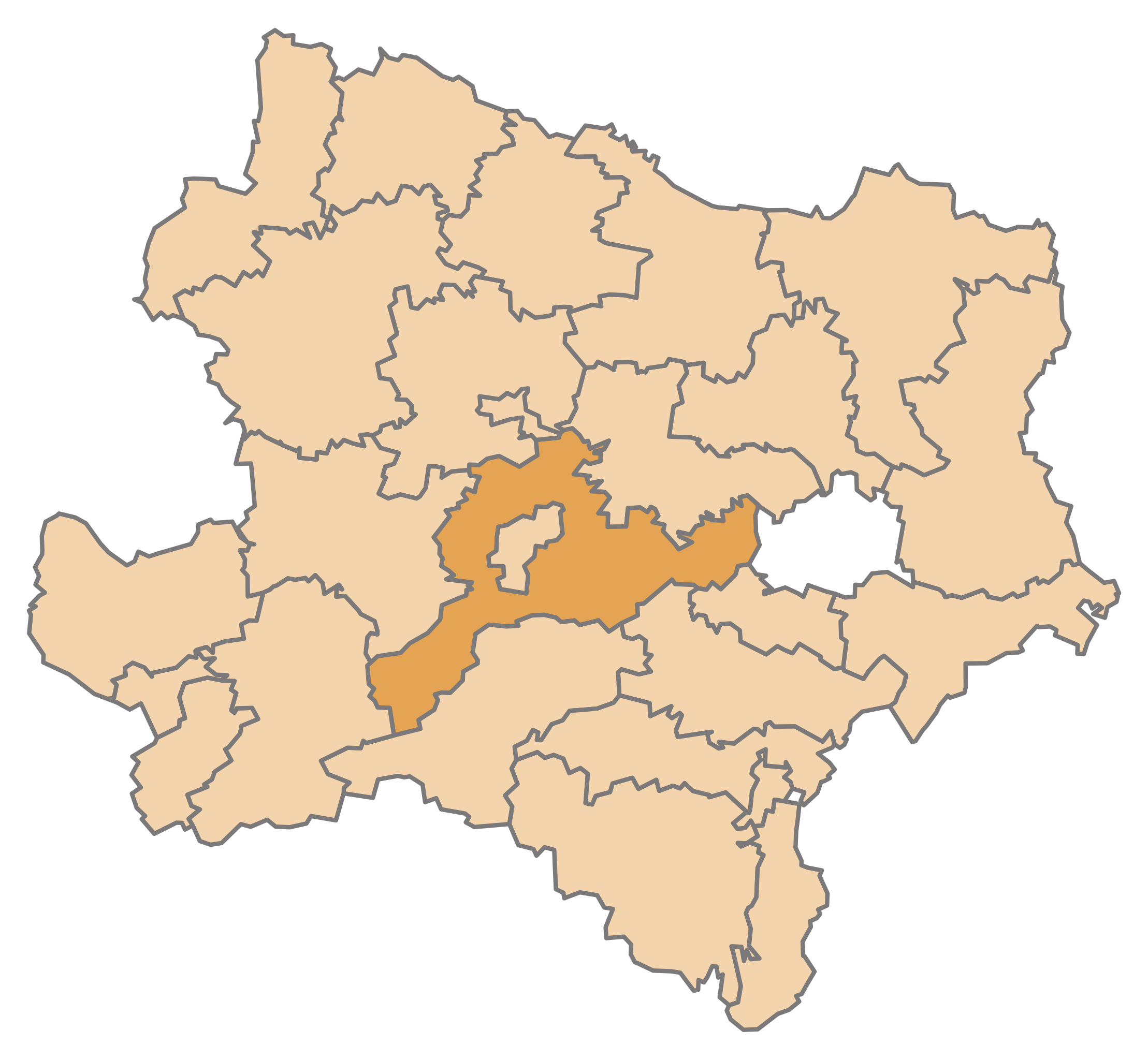
English: Map of the Austrian State Lower Austria, highlighting District St. Pölten-Land (District boundaries valid from 2017)
Deutsch: Karte des österreichischen Bundeslandes Niederösterreich, Bezirk St. Pölten-Land hervorgehoben (Bezirksgrenzen gültig ab Jänner 2017)
|
| ⧼wm-license-information-date⧽ | 2016 |
| ⧼wm-license-information-source⧽ | ⧼Wm-license-own-work⧽ |
| ⧼wm-license-information-author⧽ | AleXXw |
ترخيص
|
تاريخ الملف
اضغط على زمن/تاريخ لرؤية الملف كما بدا في هذا الزمن.
| زمن/تاريخ | صورة مصغرة | الأبعاد | مستخدم | تعليق | |
|---|---|---|---|---|---|
| حالي | ★ مراجعة معتمدة 12:06، 1 نوفمبر 2023 | | 1٬050 × 970 (56 كيلوبايت) | Pastakhov (نقاش | مساهمات) | Upload https://upload.wikimedia.org/wikipedia/commons/1/1e/Karte_A_Noe_PL_2017.svg |
لا يمكنك استبدال هذا الملف.
وصلات
لا يوجد صفحات تصل لهذه الصورة.