ملف:Kanawha Ohio confluence.jpg

حجم هذه المعاينة: 751 × 600 بكسل. البعد الآخر: 1٬500 × 1٬198 بكسل.
الملف الأصلي (1٬500 × 1٬198 بكسل حجم الملف: 724 كيلوبايت، نوع MIME: image/jpeg)
وصف قصير
| ⧼wm-license-information-description⧽ |
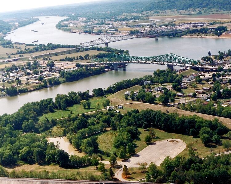
English: The confluence of the Kanawha and Ohio Rivers. The Kanawha River flows in from the left of the picture and joins the Ohio, meandering off in the distance. The town of Point Pleasant, West Virginia is in the foreground on the right. Henderson, West Virginia is on the left. The Ohio River forms the boundary between West Virginia and Ohio. The town of Gallipolis, Ohio lies in the far distance across the Ohio River. The view is to the west-southwest down the river.
|
| ⧼wm-license-information-date⧽ | before 2007 |
| ⧼wm-license-information-source⧽ | U.S. Army Corps of Engineers Digital Visual Library Image page Image description page Digital Visual Library home page |
| ⧼wm-license-information-author⧽ | Charles Johnson, U.S. Army Corps of Engineers |
| ⧼wm-license-information-permission⧽ (⧼wm-license-information-permission-reusing-text⧽) |
|
| قالب:Location/i18n | Point Pleasant, West Virginia, USA |
تاريخ الملف
اضغط على زمن/تاريخ لرؤية الملف كما بدا في هذا الزمن.
| زمن/تاريخ | صورة مصغرة | الأبعاد | مستخدم | تعليق | |
|---|---|---|---|---|---|
| حالي | ★ مراجعة معتمدة 02:26، 11 نوفمبر 2023 | | 1٬500 × 1٬198 (724 كيلوبايت) | Pastakhov (نقاش | مساهمات) | Upload https://upload.wikimedia.org/wikipedia/commons/a/ae/Kanawha_Ohio_confluence.jpg |
لا يمكنك استبدال هذا الملف.
وصلات
لا يوجد صفحات تصل لهذه الصورة.
معلومات الصورة (ميتا)
تصنيفات:
- Pages using gadget WikiMiniAtlas
- Ohio River in Ohio
- Ohio River in West Virginia
- Gallipolis, Ohio
- Crossings of the Kanawha River
- Confluences of rivers in the United States
- Aerial photographs of West Virginia
- Aerial photographs of Ohio
- Point Pleasant, West Virginia
- Roads in Mason County, West Virginia
- Mason County, West Virginia in the 2000s