ملف:Jylland overview map2.PNG

الملف الأصلي(964 × 1٬741 بكسل حجم الملف: 171 كيلوبايت، نوع MIME: image/png)
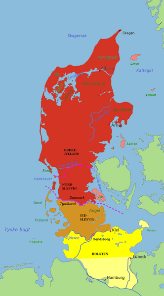
قالب:Svg

وصف قصير

⧼wm-license-information-description⧽

Jutland and the Jutland Peninsula

Red: Commonly defined as Jutland today, including the area north of the Limfjord and minor islands
Pink: The islands of Læsø, Anholt, Samsø and Als are usually attributed to Jutland as well
Brown: South Slesvig/Schleswig in the German state of Schleswig-Holstein, historically a part of Jutland
Yellow: Holstein, situated on the Jutland Peninsula, but not in Jutland itself.

The river Kongeå is the historical border between Northern and Southern Jutland (Slesvig). The river Eider is the historical southern border of Jutland (and formerly Denmark), and between Slesvig and Holstein. The city of Rendsburg and the island of Helgoland are sometimes regarded as Slesvig, sometimes not. The Jutland Peninsula as a geographic term has no fixed southern border, but at its furthest it would stretch to the river Elbe. Hamburg, however, is not a part of Holstein, and Lübeck was not a part of Holstein until the 20th century. The Jutland Peninsula may also be called the Cimbrian Peninsula, Jutland-Holstein or Jutland-Schleswig-Holstein.

⧼wm-license-information-date⧽ 2007
⧼wm-license-information-source⧽ self-made / edited from original map by Astrokey44 (GFDL).
⧼wm-license-information-author⧽ Casper

ترخيص


I, Casper, the copyright holder of this work, hereby publishes it under the following licenses:
GFDL
يسمح بنسخ و توزيع و/أو تعديل هذا المستند وفق شروط رخصة الوثائق الحرة (جنو) إصدار 1.2 أو أي إصدار أحدث المنشورة من قبل مؤسسة البرمجيات الحرة بدون أقسام ثابته و نصوص الغلاف الأمامي و الخلفي.
قالب:Cc-by-sa-3.0-migrated قالب:Cc-by-sa-2.5,2.0,1.0
[You may select the license of your choice.] Error: {{Lang}}: text has italic markup (help)

تاريخ الملف

اضغط على زمن/تاريخ لرؤية الملف كما بدا في هذا الزمن.

زمن/تاريخصورة مصغرةالأبعادمستخدمتعليق
حالي ★ مراجعة معتمدة
00:30، 3 نوفمبر 2023
تصغير للنسخة بتاريخ 00:30، 3 نوفمبر 2023964 × 1٬741 (171 كيلوبايت)Pastakhov (نقاش | مساهمات)Upload https://upload.wikimedia.org/wikipedia/commons/5/5f/Jylland_overview_map2.PNG

لا يوجد صفحات تصل لهذه الصورة.