ملف:Jenkins' Ferry Battlefield Arkansas.jpg
حجم هذه المعاينة: 457 × 600 بكسل. البعد الآخر: 1٬410 × 1٬850 بكسل.
الملف الأصلي (1٬410 × 1٬850 بكسل حجم الملف: 1٫12 ميجابايت، نوع MIME: image/jpeg)
وصف قصير
| ⧼wm-license-information-description⧽ |
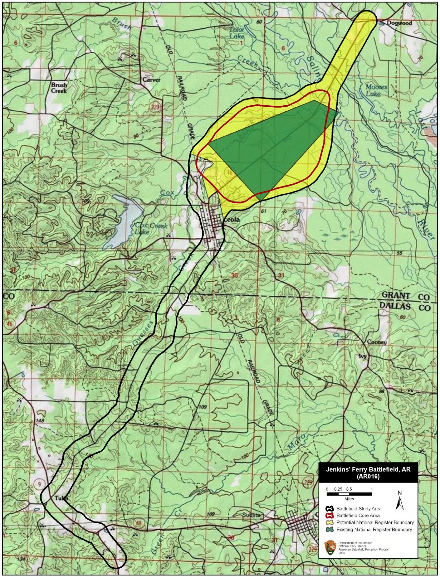
English: Map of battlefield core and study areas.
The ABPP revised the Study Area to more accurately reflect troop movements, areas of fighting, and historic road alignments. The route from the south was used by both Federal and Confederate forces to approach the combat area. The route to the north is the Federal route of withdrawal across the Saline River and onto high ground (the Confederates did not cross the river). The 1993 Core Area was realigned along the historic roadbed and widened to include lines of battle and to reflect more accurately the scope of the fighting. Land north of the Saline River was removed from the Core Area because no fighting has been documented on that side of the river. |
| ⧼wm-license-information-date⧽ | 2011 |
| ⧼wm-license-information-source⧽ | National Park Service |
| ⧼wm-license-information-author⧽ | American Battlefield Protection Program |
ترخيص
تاريخ الملف
اضغط على زمن/تاريخ لرؤية الملف كما بدا في هذا الزمن.
| زمن/تاريخ | صورة مصغرة | الأبعاد | مستخدم | تعليق | |
|---|---|---|---|---|---|
| حالي | ★ مراجعة معتمدة 07:33، 16 يناير 2024 | | 1٬410 × 1٬850 (1٫12 ميجابايت) | Pastakhov (نقاش | مساهمات) | Upload https://upload.wikimedia.org/wikipedia/commons/0/06/Jenkins%27_Ferry_Battlefield_Arkansas.jpg |
لا يمكنك استبدال هذا الملف.
وصلات
لا يوجد صفحات تصل لهذه الصورة.