ملف:Jade-weser-muendung map de.svg

حجم معاينة PNG لذلك الملف ذي الامتداد SVG: 646 × 600 بكسل. البعد الآخر: 2٬206 × 2٬048 بكسل.
الملف الأصلي (ملف SVG، أبعاده 1٬483 × 1٬377 بكسل، حجم الملف: 617 كيلوبايت)
وصف قصير
قالب:Igen
| ⧼wm-license-information-description⧽ |
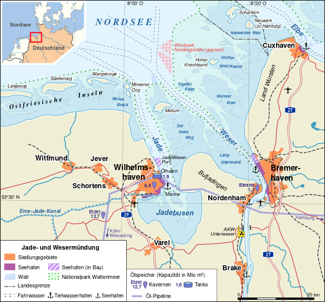
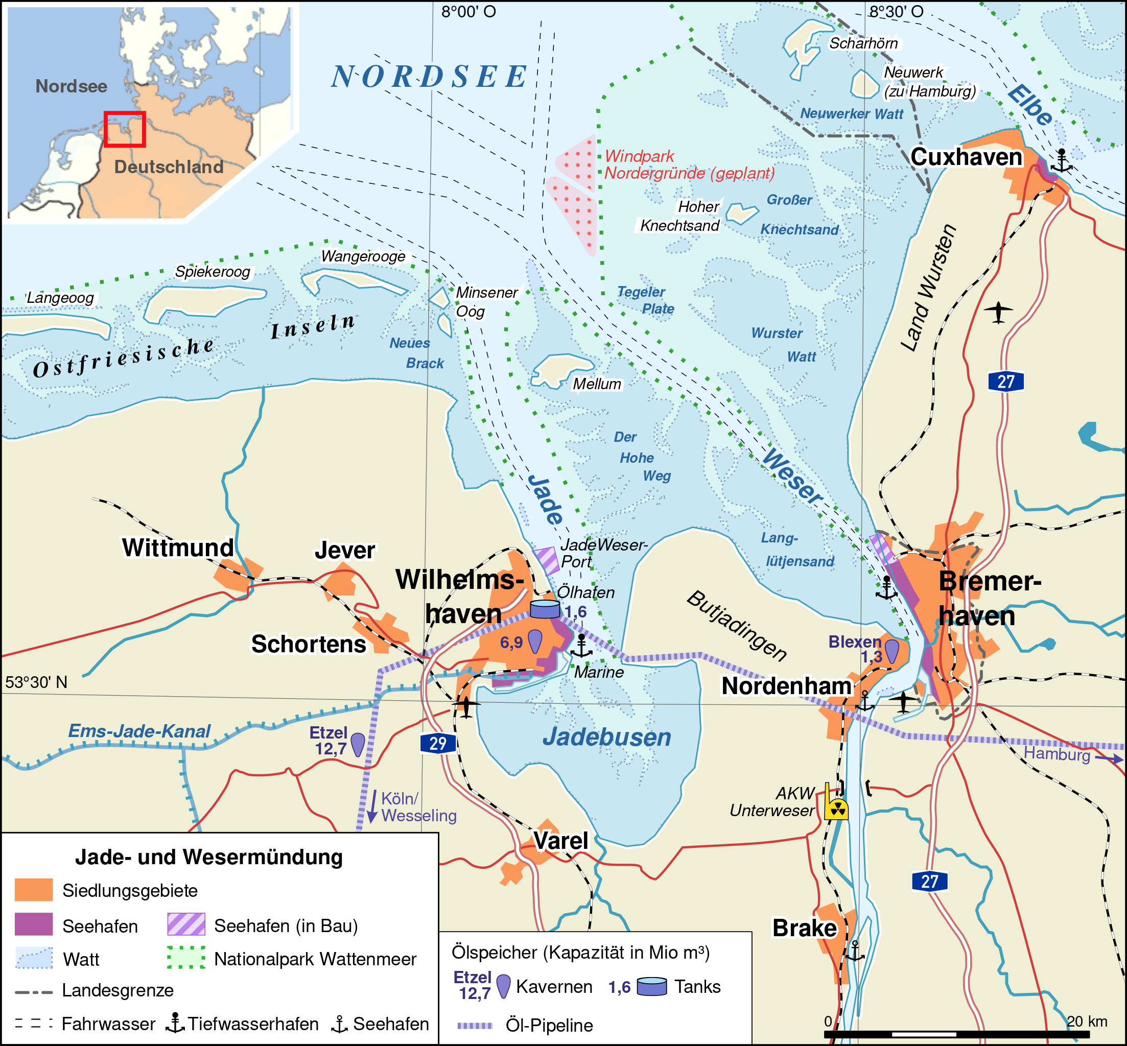
Deutsch: Übersichtskarte Jade- und Wesermündung
|
| ⧼wm-license-information-date⧽ | 2008 |
| ⧼wm-license-information-source⧽ | ⧼Wm-license-own-work⧽ (قالب:Original text) Topography: vmap0 (Vector Map Level 0), Openstreetmap Project, Corine Land Cover (Copyright EEA Copenhagen, 2007, http://eea.europa.eu) |
| ⧼wm-license-information-author⧽ | Alexrk |
| ⧼wm-license-information-other-versions⧽ |
قالب:Bitmap version available قالب:Other versions/Jade-weser-muendung map |
ترخيص
|
تاريخ الملف
اضغط على زمن/تاريخ لرؤية الملف كما بدا في هذا الزمن.
| زمن/تاريخ | صورة مصغرة | الأبعاد | مستخدم | تعليق | |
|---|---|---|---|---|---|
| حالي | ★ مراجعة معتمدة 13:22، 6 نوفمبر 2023 | | 1٬483 × 1٬377 (617 كيلوبايت) | Pastakhov (نقاش | مساهمات) | Upload https://upload.wikimedia.org/wikipedia/commons/2/2d/Jade-weser-muendung_map_de.svg |
لا يمكنك استبدال هذا الملف.
وصلات
لا يوجد صفحات تصل لهذه الصورة.
معلومات الصورة (ميتا)
تصنيفات:
- Self-published work
- 2008 maps of Lower Saxony
- 2008 maps of Hamburg
- SVG maps of Lower Saxony
- SVG maps of Hamburg
- Brake
- Bundesautobahn 27
- Bundesautobahn 29
- Butjadingen
- Estuaries of Germany
- Files by User:Alexrk2
- Innenjade
- Maps of Jever
- Maps of Cuxhaven
- Maps of East Frisia
- Maps of Jadebusen
- Maps of Langeoog
- Maps of Hamburg-Neuwerk
- Maps of Spiekeroog
- Maps of Weser
- Maps of the North Sea
- Maps of the Wadden Sea
- Nordenham
- Maps of Schortens
- Maps of Varel
- Maps of Wangerooge
- Weser in Bremerhaven
- Wilhelmshaven
- Wittmund