ملف:Indonesia Jambi location map.svg

حجم معاينة PNG لذلك الملف ذي الامتداد SVG: 600 × 600 بكسل. البعد الآخر: 2٬048 × 2٬048 بكسل.
الملف الأصلي (ملف SVG، أبعاده 1٬250 × 1٬250 بكسل، حجم الملف: 2٫24 ميجابايت)
وصف قصير
| ⧼wm-license-information-description⧽ |
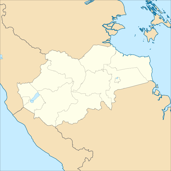
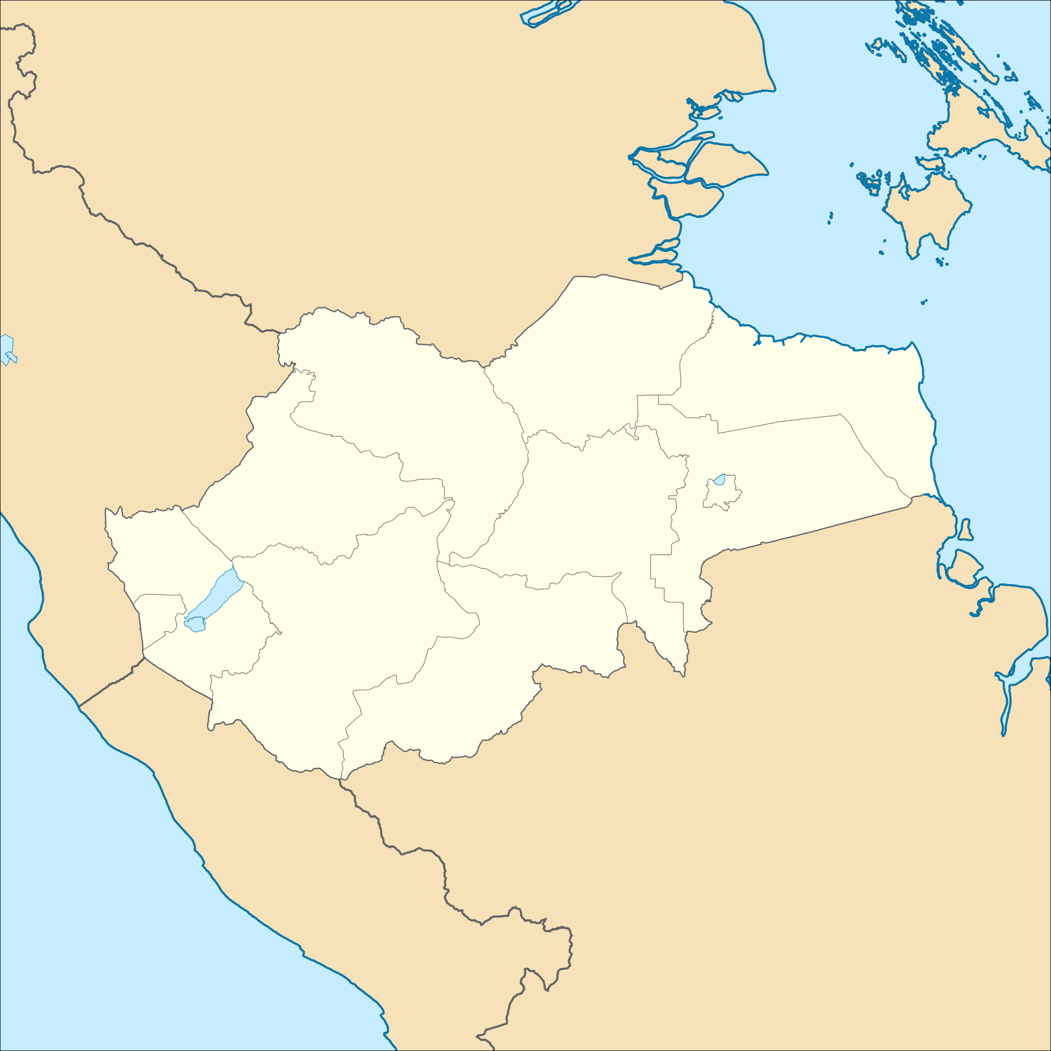
English: Location map of Jambi, Indonesia
Geographic Coordinate System WGS 1984 (EPSG: 4326) Equirectangular Projection Geographic limits of the map:
|
| ⧼wm-license-information-date⧽ | 2017 |
| ⧼wm-license-information-source⧽ | ⧼Wm-license-own-work⧽ |
| ⧼wm-license-information-author⧽ | Mandamaruta |
ترخيص
|
تاريخ الملف
اضغط على زمن/تاريخ لرؤية الملف كما بدا في هذا الزمن.
| زمن/تاريخ | صورة مصغرة | الأبعاد | مستخدم | تعليق | |
|---|---|---|---|---|---|
| حالي | ★ مراجعة معتمدة 06:29، 3 مارس 2024 | | 1٬250 × 1٬250 (2٫24 ميجابايت) | Pastakhov (نقاش | مساهمات) | Upload https://upload.wikimedia.org/wikipedia/commons/5/59/Indonesia_Jambi_location_map.svg |
لا يمكنك استبدال هذا الملف.
وصلات
لا يوجد صفحات تصل لهذه الصورة.