ملف:Iceage north-intergl glac hg.png
حجم هذه المعاينة: 600 × 600 بكسل. البعدان الآخران: 2٬048 × 2٬048 بكسل | 3٬000 × 3٬000 بكسل.
الملف الأصلي (3٬000 × 3٬000 بكسل حجم الملف: 8٫75 ميجابايت، نوع MIME: image/png)
| ⧼wm-license-information-description⧽ |
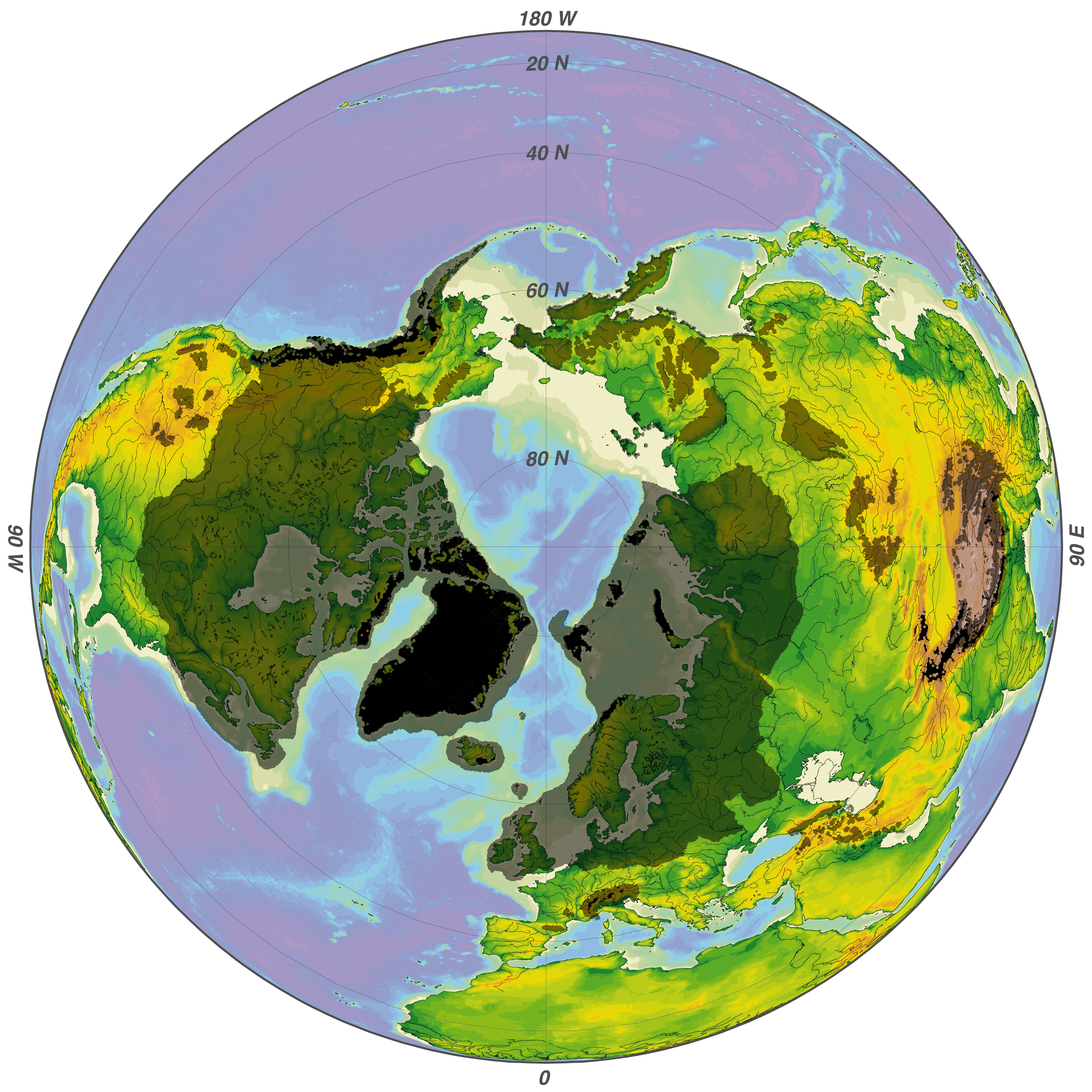
Recent (black) and maximum (grey) glaciation of the northern hemisphere during the Quaternary climatic cycles
|
| ⧼wm-license-information-date⧽ | 2008 |
| ⧼wm-license-information-source⧽ | ⧼Wm-license-own-work⧽ |
| ⧼wm-license-information-author⧽ | Hannes Grobe/AWI |
| ⧼wm-license-information-other-versions⧽ |
|

تاريخ الملف
اضغط على زمن/تاريخ لرؤية الملف كما بدا في هذا الزمن.
| زمن/تاريخ | صورة مصغرة | الأبعاد | مستخدم | تعليق | |
|---|---|---|---|---|---|
| حالي | ★ مراجعة معتمدة 18:00، 11 نوفمبر 2023 | | 3٬000 × 3٬000 (8٫75 ميجابايت) | Pastakhov (نقاش | مساهمات) | Upload https://upload.wikimedia.org/wikipedia/commons/e/ef/Iceage_north-intergl_glac_hg.png |
لا يمكنك استبدال هذا الملف.
وصلات
الصفحات التالية تحتوي على وصلة لهذه الصورة: