ملف:IRPŻmudzkie.PNG

حجم هذه المعاينة: 765 × 600 بكسل. البعد الآخر: 2٬000 × 1٬568 بكسل.
الملف الأصلي (2٬000 × 1٬568 بكسل حجم الملف: 170 كيلوبايت، نوع MIME: image/png)
وصف قصير
| ⧼wm-license-information-description⧽ |
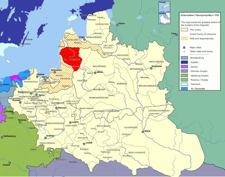
NOTE: This map is not accurate as the Duchy extended a bit south of the Neman River. Compare with Image:Eldership of Samogitia (Žemaitija) within Lithuania in the 17th century.png. Two other errors are: 1) The island of Gotland was part of Denmark until 1645. 2) The town of Brømsebro is incorrectly placed. It is located on the eastern extremity of the former border between Denmark and Sweden. Duchy of Samogitia in 1635 authors user:halibutt and user:Mathiasrex |
| ⧼wm-license-information-date⧽ | قالب:Original upload date |
| ⧼wm-license-information-source⧽ | No machine-readable source provided. Own work assumed (based on copyright claims). |
| ⧼wm-license-information-author⧽ | No machine-readable author provided. Mathiasrex assumed (based on copyright claims). |
ترخيص
قالب:Cc-by-sa-3.0-migrated |

_within_Lithuania_in_the_17th_century.png&action=edit&redlink=1)
تاريخ الملف
اضغط على زمن/تاريخ لرؤية الملف كما بدا في هذا الزمن.
| زمن/تاريخ | صورة مصغرة | الأبعاد | مستخدم | تعليق | |
|---|---|---|---|---|---|
| حالي | ★ مراجعة معتمدة 21:14، 12 نوفمبر 2023 | | 2٬000 × 1٬568 (170 كيلوبايت) | Pastakhov (نقاش | مساهمات) | Upload https://upload.wikimedia.org/wikipedia/commons/b/bf/IRP%C5%BBmudzkie.PNG |
لا يمكنك استبدال هذا الملف.
وصلات
لا يوجد صفحات تصل لهذه الصورة.