ملف:Hove, Western Road - geograph.org.uk - 844703.jpg
لا توجد دقة أعلى متوفرة.
Hove,_Western_Road_-_geograph.org.uk_-_844703.jpg (640 × 480 بكسل حجم الملف: 69 كيلوبايت، نوع MIME: image/jpeg)
وصف قصير
| ⧼wm-license-information-description⧽ |
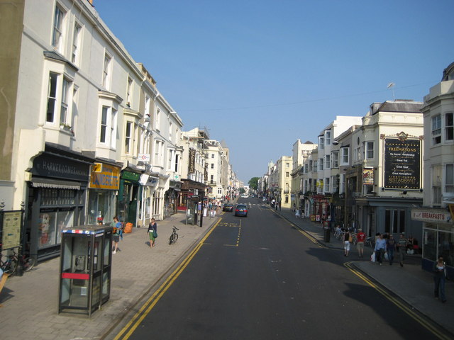
English: Hove: Western Road The Freemasons public house is on the right with Brunswick Street West in front of it. Western Road is also the B2066 through here.
|
| ⧼wm-license-information-date⧽ | 2008 |
| ⧼wm-license-information-source⧽ | From geograph.org.uk |
| ⧼wm-license-information-author⧽ | Nigel Cox |
| ⧼wm-license-cc-attribution⧽ (قالب:I18n/Credit line) |
Nigel Cox / Hove: Western Road / |
50°49′34″N 0°09′40″W / 50.8260°N 0.161°W قالب:Object location
_heading:112)
ترخيص
تاريخ الملف
اضغط على زمن/تاريخ لرؤية الملف كما بدا في هذا الزمن.
| زمن/تاريخ | صورة مصغرة | الأبعاد | مستخدم | تعليق | |
|---|---|---|---|---|---|
| حالي | ★ مراجعة معتمدة 23:22، 8 نوفمبر 2023 | | 640 × 480 (69 كيلوبايت) | Pastakhov (نقاش | مساهمات) | Upload https://upload.wikimedia.org/wikipedia/commons/3/36/Hove%2C_Western_Road_-_geograph.org.uk_-_844703.jpg |
لا يمكنك استبدال هذا الملف.
وصلات
لا يوجد صفحات تصل لهذه الصورة.