ملف:Hong Kong Yau Tsim Mong District locator map.svg

حجم معاينة PNG لذلك الملف ذي الامتداد SVG: 766 × 600 بكسل. البعد الآخر: 2٬560 × 2٬004 بكسل.
الملف الأصلي (ملف SVG، أبعاده 1٬298 × 1٬016 بكسل، حجم الملف: 245 كيلوبايت)
وصف قصير
| ⧼wm-license-information-description⧽ |
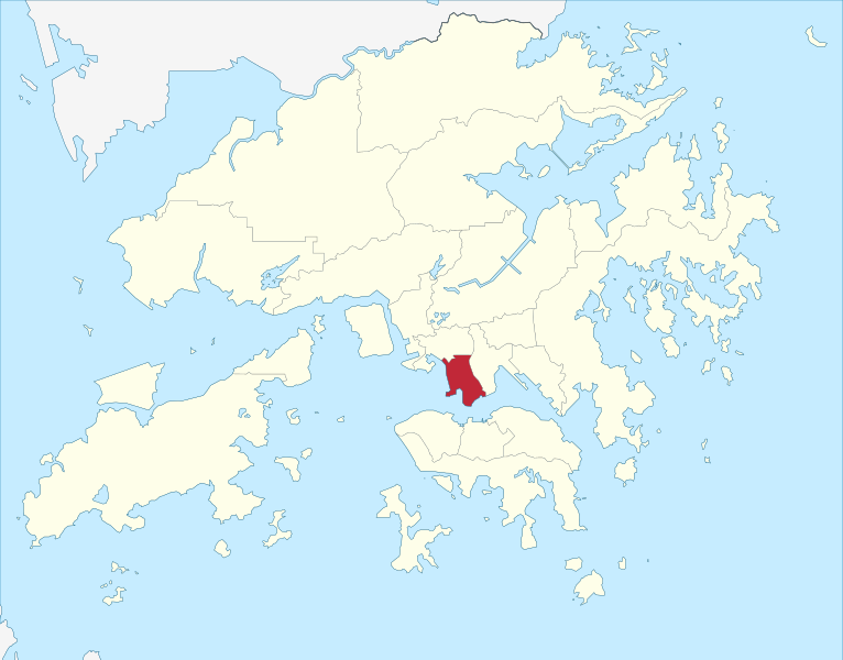
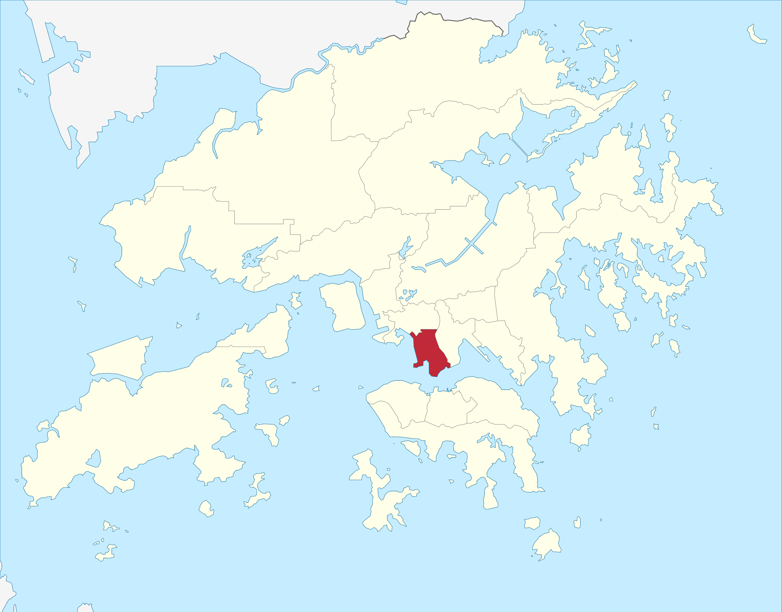
English: Locator map of Yau Tsim Mong District, Hong Kong.
|
| ⧼wm-license-information-date⧽ | 2013-04-21 13:47 (UTC) |
| ⧼wm-license-information-source⧽ | قالب:Derived from |
| ⧼wm-license-information-author⧽ |
|
| ⧼wm-license-information-other-versions⧽ |
ترخيص
|
|
هذا الملفُّ مُرخَّص بموجب رخصة المشاع الإبداعي نسبة المُصنَّف إِلى مؤلفه - المشاركة بالمثل 3.0 العامة. |
قالب:Original upload log
This image is a derivative work of the following images:
- File:China_Hong_Kong_location_map.svg licensed with Cc-by-sa-3.0, GFDL
- 2011-09-11T09:39:11Z Peterwhy 1298x1016 (251325 Bytes) Hand edited to reduce size
- 2010-04-04T16:22:50Z Chumwa 1298x1016 (470567 Bytes) == {{int:filedesc}} == {{Information |Description= {{de|Postionskarte von [[:de:Hong Kong|Hong Kong]]}} Quadratische Plattkarte. Geographische Begrenzung der Karte: * N: 22°34'14" N (22.5706°N) * S: 22°07'12" N (22.12°N
تاريخ الملف
اضغط على زمن/تاريخ لرؤية الملف كما بدا في هذا الزمن.
| زمن/تاريخ | صورة مصغرة | الأبعاد | مستخدم | تعليق | |
|---|---|---|---|---|---|
| حالي | ★ مراجعة معتمدة 13:27، 6 نوفمبر 2023 | | 1٬298 × 1٬016 (245 كيلوبايت) | Pastakhov (نقاش | مساهمات) | Upload https://upload.wikimedia.org/wikipedia/commons/c/c0/Hong_Kong_Yau_Tsim_Mong_District_locator_map.svg |
لا يمكنك استبدال هذا الملف.
وصلات
لا يوجد صفحات تصل لهذه الصورة.