ملف:Hohenweiler Dorfzentrum Schrägluftbild.jpg
حجم هذه المعاينة: 800 × 500 بكسل. البعدان الآخران: 2٬560 × 1٬600 بكسل | 5٬000 × 3٬125 بكسل.
الملف الأصلي (5٬000 × 3٬125 بكسل حجم الملف: 15٫73 ميجابايت، نوع MIME: image/jpeg)
وصف قصير
| ⧼wm-license-information-description⧽ |
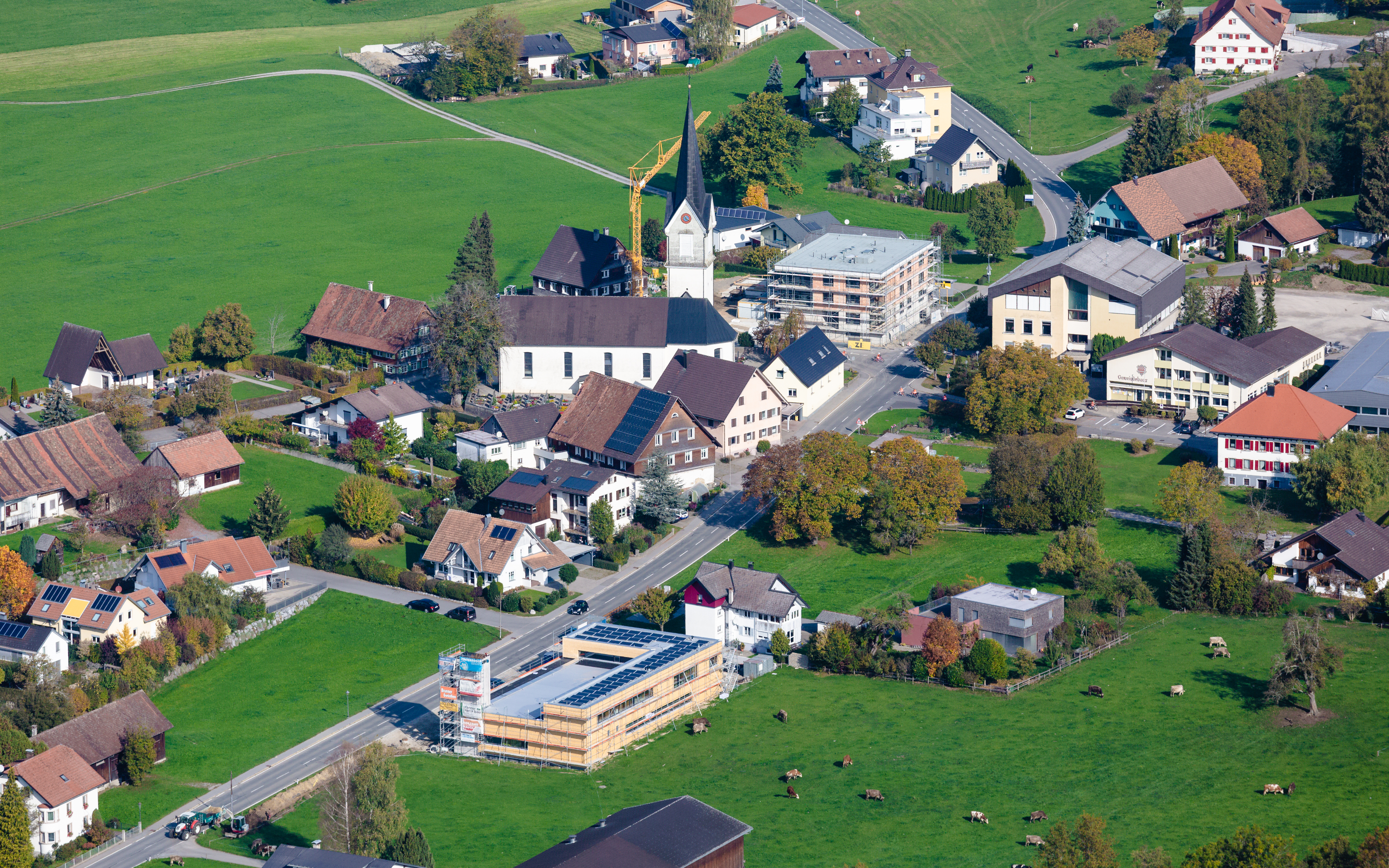
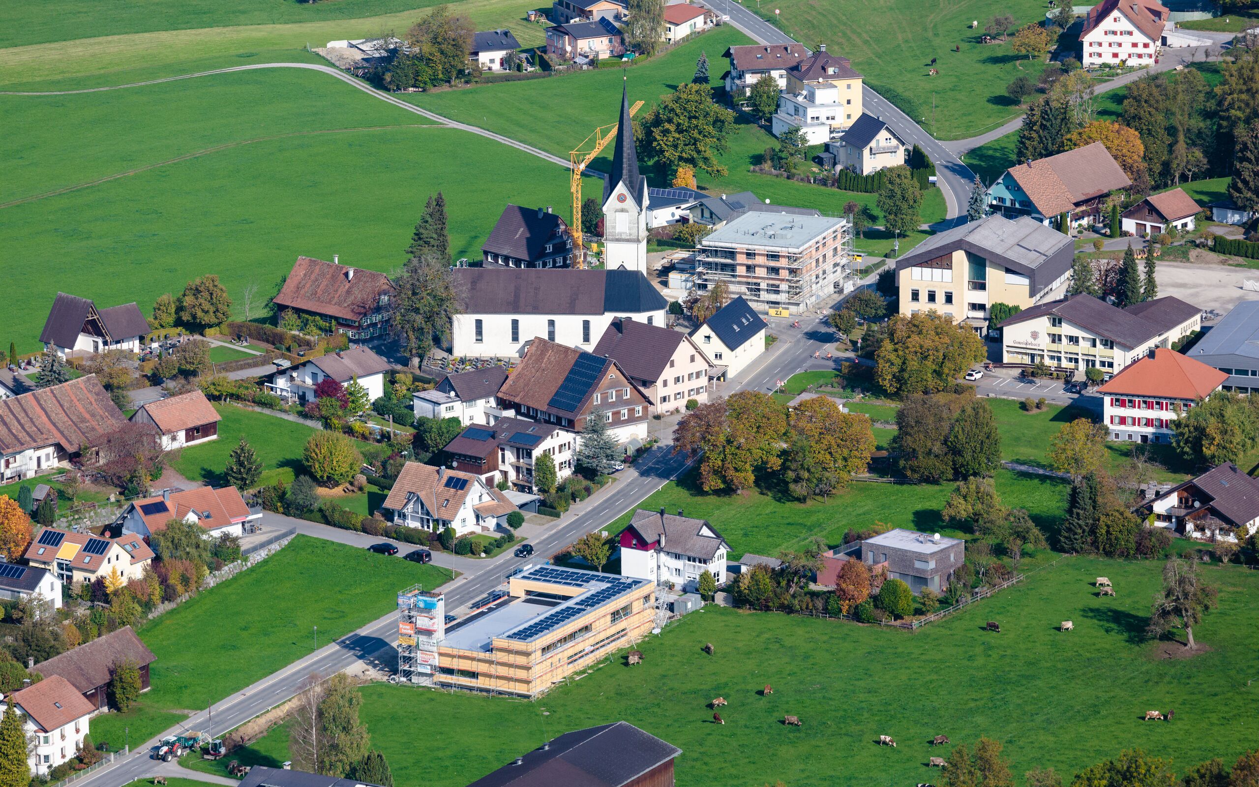
Deutsch: Luftbild vom Dorfzentrum von Hohenweiler
|
| ⧼wm-license-information-date⧽ | 2018, {{time}} – invalid date format 18 (help) |
| ⧼wm-license-information-source⧽ | ⧼Wm-license-own-work⧽ |
| ⧼wm-license-information-author⧽ | Herbert Heim |
47°34′39″N 9°46′54″E / 47.577556°N 9.781802°E
ترخيص
|
تاريخ الملف
اضغط على زمن/تاريخ لرؤية الملف كما بدا في هذا الزمن.
| زمن/تاريخ | صورة مصغرة | الأبعاد | مستخدم | تعليق | |
|---|---|---|---|---|---|
| حالي | ★ مراجعة معتمدة 00:28، 3 ديسمبر 2023 | | 5٬000 × 3٬125 (15٫73 ميجابايت) | Pastakhov (نقاش | مساهمات) | Upload https://upload.wikimedia.org/wikipedia/commons/8/82/Hohenweiler_Dorfzentrum_Schr%C3%A4gluftbild.jpg |
لا يمكنك استبدال هذا الملف.
وصلات
لا يوجد صفحات تصل لهذه الصورة.