ملف:Historical atlas of Peel County image Peel County Courthouse.tif

حجم معاينة PNG لذلك الملف ذي الامتداد TIF: 800 × 550 بكسل. البعد الآخر: 2٬560 × 1٬759 بكسل.
الملف الأصلي (10٬118 × 6٬954 بكسل حجم الملف: 33٫89 ميجابايت، نوع MIME: image/tiff)
وصف قصير
| ⧼wm-license-information-description⧽ |
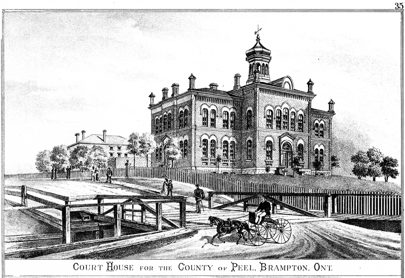
English: An illustration of the Peel County Courthouse, as seen in the Atlas.
|
| ⧼wm-license-information-date⧽ | 1877 |
| ⧼wm-license-information-source⧽ | "Illustrated historical atlas of the County of Peel, Ont." Toronto : Walker & Miles, 1877. |
| ⧼wm-license-information-author⧽ | J. H. Pope |
43°41′06″N 79°45′27″W / 43.684928°N 79.757591°W
ترخيص
تاريخ الملف
اضغط على زمن/تاريخ لرؤية الملف كما بدا في هذا الزمن.
| زمن/تاريخ | صورة مصغرة | الأبعاد | مستخدم | تعليق | |
|---|---|---|---|---|---|
| حالي | ★ مراجعة معتمدة 12:27، 14 نوفمبر 2023 |  | 10٬118 × 6٬954 (33٫89 ميجابايت) | Pastakhov (نقاش | مساهمات) | Upload https://upload.wikimedia.org/wikipedia/commons/1/1c/Historical_atlas_of_Peel_County_image_Peel_County_Courthouse.tif |
لا يمكنك استبدال هذا الملف.
وصلات
لا يوجد صفحات تصل لهذه الصورة.