ملف:Herm from the air - geograph.ci - 372.jpg
لا توجد دقة أعلى متوفرة.
Herm_from_the_air_-_geograph.ci_-_372.jpg (640 × 427 بكسل حجم الملف: 258 كيلوبايت، نوع MIME: image/jpeg)
| ⧼wm-license-information-description⧽ |
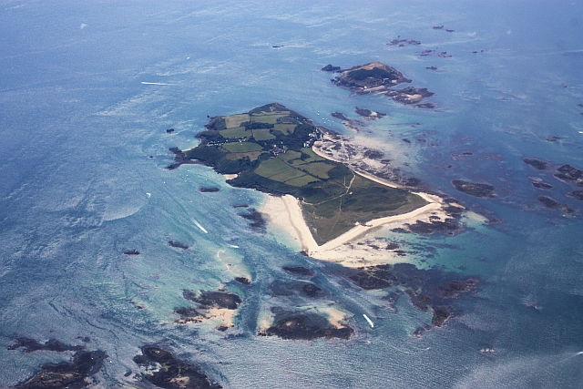
Herm from the air. Viewed from the north. |
| ⧼wm-license-information-date⧽ | 2009 |
| ⧼wm-license-information-source⧽ | From channel-islands.geographs.org; transferred by User:oxyman using geograph_org2commons. |
| ⧼wm-license-information-author⧽ | Bob Embleton |
| ⧼wm-license-information-permission⧽ (⧼wm-license-information-permission-reusing-text⧽) |
Creative Commons Attribution Share-alike license 2.0 |
تاريخ الملف
اضغط على زمن/تاريخ لرؤية الملف كما بدا في هذا الزمن.
| زمن/تاريخ | صورة مصغرة | الأبعاد | مستخدم | تعليق | |
|---|---|---|---|---|---|
| حالي | ★ مراجعة معتمدة 03:42، 20 أكتوبر 2023 | | 640 × 427 (258 كيلوبايت) | Pastakhov (نقاش | مساهمات) | Upload https://upload.wikimedia.org/wikipedia/commons/4/44/Herm_from_the_air_-_geograph.ci_-_372.jpg |
لا يمكنك استبدال هذا الملف.
وصلات
لا يوجد صفحات تصل لهذه الصورة.