ملف:Herford - NSG Bramschebach-Nagelsbachtal - Map.png
حجم هذه المعاينة: 779 × 600 بكسل. البعد الآخر: 843 × 649 بكسل.
الملف الأصلي (843 × 649 بكسل حجم الملف: 633 كيلوبايت، نوع MIME: image/png)
وصف قصير
| ⧼wm-license-information-description⧽ |
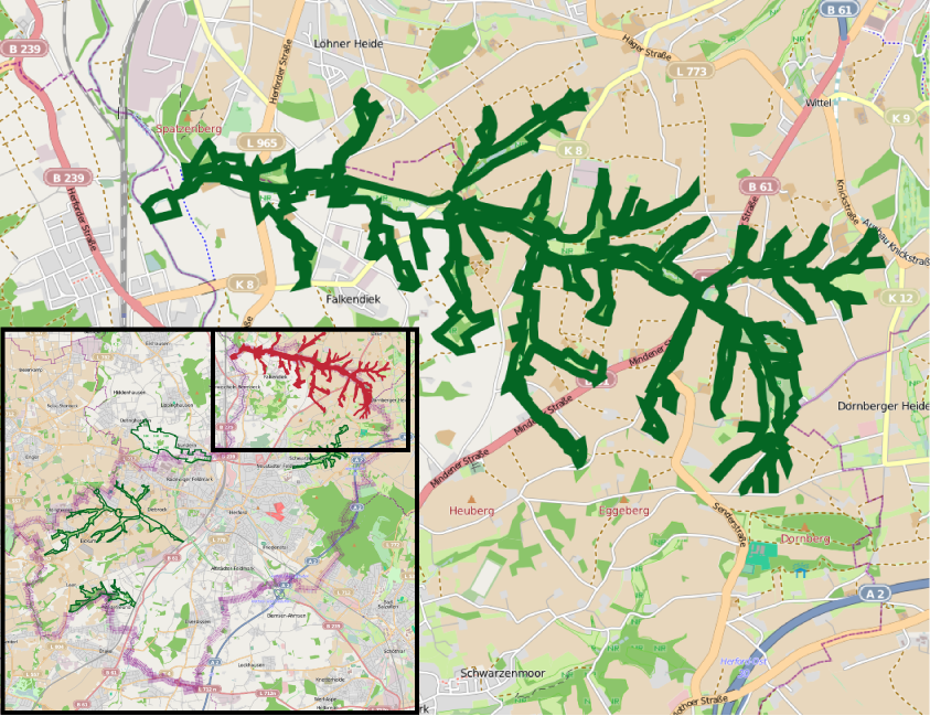
English: Herford - Nature reserve Bramschebach-Nagelsbachtal - overview map
Number and borders of nature reserves are subject to frequent change. In order to facilitate reproduction of this map from openstreetmap, the following data is stored here: export boundaries: north: 52.18; west: 8.654; east: 8.76; south: 52.13; mapnik svg, scale 1:50.000 nature reserve stroke color: R 5, G 102, B 36; municipality border stroke weight: as found Français : Herford - Réserve naturelle Bramschebach-Nagelsbachtal - vue d'ensemble
|
| ⧼wm-license-information-date⧽ | 2011 |
| ⧼wm-license-information-source⧽ | Open Street Map |
| ⧼wm-license-information-author⧽ | ⧼Wm-license-own-work⧽ |
| ⧼wm-license-information-permission⧽ (⧼wm-license-information-permission-reusing-text⧽) |
Licensed under the GFDL by author |
ترخيص
تاريخ الملف
اضغط على زمن/تاريخ لرؤية الملف كما بدا في هذا الزمن.
| زمن/تاريخ | صورة مصغرة | الأبعاد | مستخدم | تعليق | |
|---|---|---|---|---|---|
| حالي | ★ مراجعة معتمدة 20:03، 4 أكتوبر 2023 | | 843 × 649 (633 كيلوبايت) | Pastakhov (نقاش | مساهمات) | Upload https://upload.wikimedia.org/wikipedia/commons/3/31/Herford_-_NSG_Bramschebach-Nagelsbachtal_-_Map.png |
لا يمكنك استبدال هذا الملف.
وصلات
لا يوجد صفحات تصل لهذه الصورة.