ملف:Helions Bumpstead - geograph.org.uk - 1763934.jpg
لا توجد دقة أعلى متوفرة.
Helions_Bumpstead_-_geograph.org.uk_-_1763934.jpg (640 × 427 بكسل حجم الملف: 73 كيلوبايت، نوع MIME: image/jpeg)
وصف قصير
| ⧼wm-license-information-description⧽ |
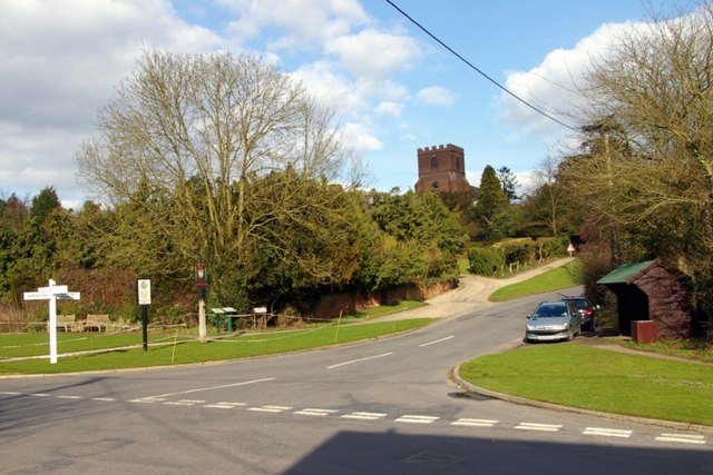
English: Helions Bumpstead. Looking towards St Andrew's Church from the crossroads in the village centre, nearly fifty years on from Ben Brooksbank's photo of the same view 1744122
The changes are few and relatively subtle. An array of signs has appeared on the opposite corner: a traditional-style fingerpost, a decorative village sign https://www.geograph.org.uk/photo/1763961 a plaque celebrating a Best-kept Village award and a plan of public footpaths in the parish. On the right a bus shelter and litter bin have appeared and the cars parked in the lay-by are no longer British marques! The telephone cables have been laid underground but the power lines are still overhead. And of course the pre-Worboys "bend" sign in Church Hill has given way to the modern standard.
|
| ⧼wm-license-information-date⧽ | 2010 |
| ⧼wm-license-information-source⧽ | From geograph.org.uk |
| ⧼wm-license-information-author⧽ | James Yardley |
52°02′54″N 0°24′19″E / 52.04826°N 0.4054°E قالب:Object location
_heading:90)
ترخيص
تاريخ الملف
اضغط على زمن/تاريخ لرؤية الملف كما بدا في هذا الزمن.
| زمن/تاريخ | صورة مصغرة | الأبعاد | مستخدم | تعليق | |
|---|---|---|---|---|---|
| حالي | ★ مراجعة معتمدة 00:01، 13 أكتوبر 2023 | | 640 × 427 (73 كيلوبايت) | Pastakhov (نقاش | مساهمات) | Upload https://upload.wikimedia.org/wikipedia/commons/3/32/Helions_Bumpstead_-_geograph.org.uk_-_1763934.jpg |
لا يمكنك استبدال هذا الملف.
وصلات
لا يوجد صفحات تصل لهذه الصورة.